Latitude: 53.7285 / 53°43'42"N
Longitude: -1.3497 / 1°20'58"W
OS Eastings: 443003
OS Northings: 425981
OS Grid: SE430259
Mapcode National: GBR MT0B.L5
Mapcode Global: WHDC0.7KK1
Plus Code: 9C5WPMH2+94
Entry Name: Castleford Bridge
Listing Date: 16 March 1987
Grade: II
Source: Historic England
Source ID: 1290033
English Heritage Legacy ID: 342466
ID on this website: 101290033
Location: Castleford Ings, Wakefield, West Yorkshire, WF10
County: Wakefield
Electoral Ward/Division: Castleford Central and Glasshoughton
Parish: Non Civil Parish
Built-Up Area: Castleford
Traditional County: Yorkshire
Lieutenancy Area (Ceremonial County): West Yorkshire
Church of England Parish: Castleford Team Parish
Church of England Diocese: Leeds
Tagged with: Bridge
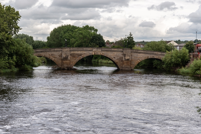
CASTLEFORD LOCK LANE SE42NW 1/4 Castleford Bridge 16.3.1987 - II Public road bridge over River Calder. Dated on parapets, 1805, by Bernard Hartley, built 1808 by Jesse Hartley. Sandstone ashlar. Classical style. Three segmental arches with rusticated voussoirs, scrolled keystones on east side and vermiculated keystones on west side; guilloche frieze, plain parapets with rounded coping, with lettered panels in the centre: "BERNARD HARTLEY (west side) ARCHITECT 1805" and "JESSE HARTLEY (east side) BUILDER 1808" Triangular cutwaters and canted piers, finished with concave sweep to the parapet, and all of banded rustication. Rectangular terminal piers of similar masonry have blind window panels with splayed voussoirs, modillioned cornices and panelled parapets. Ramped approach at north end, and drum terminals at both ends.
Listing NGR: SE4300325981
External links are from the relevant listing authority and, where applicable, Wikidata. Wikidata IDs may be related buildings as well as this specific building. If you want to add or update a link, you will need to do so by editing the Wikidata entry.


Other nearby listed buildings