Approximate Location Map
Large Map »
Latitude: 51.4129 / 51°24'46"N
Longitude: -1.5161 / 1°30'57"W
OS Eastings: 433749
OS Northings: 168314
OS Grid: SU337683
Mapcode National: GBR 706.7J9
Mapcode Global: VHC1S.NRV8
Plus Code: 9C3WCF7M+4H
Entry Name: 84, High Street
Listing Date: 8 June 1984
Grade: II
Source: Historic England
Source ID: 1290096
English Heritage Legacy ID: 395772
ID on this website: 101290096
Location: Hungerford, West Berkshire, RG17
County: West Berkshire
Civil Parish: Hungerford
Built-Up Area: Hungerford
Traditional County: Berkshire
Lieutenancy Area (Ceremonial County): Berkshire
Church of England Parish: Hungerford with Denford
Church of England Diocese: Oxford
Tagged with: Building Thatched cottage
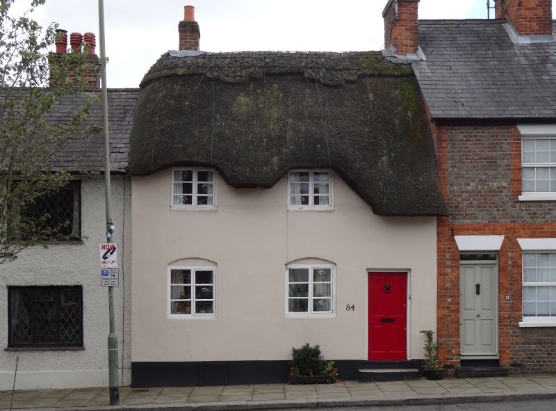
HUNGERFORD HIGH STREET (East side)
SU 3368
18/88 No.84
II
Cottage. C18. Thatched roof, chimney to left, thatch dressed around
2 eaves dormers, rendered wall, thin timber framing visible internally.
One and a half storeys. 2, C20 casements to left, C20 door to right.
Listing NGR: SU3374968314
External links are from the relevant listing authority and, where applicable, Wikidata. Wikidata IDs may be related buildings as well as this specific building. If you want to add or update a link, you will need to do so by editing the Wikidata entry.


Other nearby listed buildings
