Approximate Location Map
Large Map »
Latitude: 53.6303 / 53°37'48"N
Longitude: -1.8243 / 1°49'27"W
OS Eastings: 411717
OS Northings: 414873
OS Grid: SE117148
Mapcode National: GBR HVPG.VD
Mapcode Global: WHCB6.Y0GS
Plus Code: 9C5WJ5JG+47
Entry Name: Crosland Hall Cottage
Listing Date: 29 September 1978
Grade: II
Source: Historic England
Source ID: 1290351
English Heritage Legacy ID: 339742
ID on this website: 101290351
Location: Crosland Hill, Kirklees, West Yorkshire, HD4
County: Kirklees
Electoral Ward/Division: Crosland Moor and Netherton
Parish: Non Civil Parish
Built-Up Area: Huddersfield
Traditional County: Yorkshire
Lieutenancy Area (Ceremonial County): West Yorkshire
Church of England Parish: Crosland Moor St Barnabas
Church of England Diocese: Leeds
Tagged with: Cottage
CROSLAND HILL ROAD
1.
5113
(West Side)
Crosland Moor
Crosland Hall Cottage
SE 1114 42/411
II GV
2.
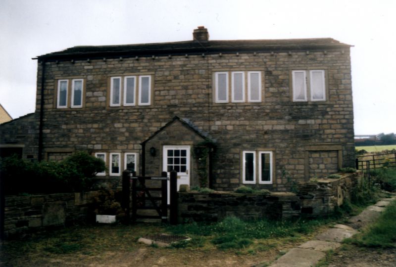
Early C19. Hammer-dressed stone. Pitched stone slate roof. 2 storeys. Ground
floor altered. 1st floor has 2 two-light and 2 three-light stone mullioned
windows, mostly blocked.
Listing NGR: SE1171714873
External links are from the relevant listing authority and, where applicable, Wikidata. Wikidata IDs may be related buildings as well as this specific building. If you want to add or update a link, you will need to do so by editing the Wikidata entry.


Other nearby listed buildings
