Latitude: 50.7062 / 50°42'22"N
Longitude: -1.5005 / 1°30'1"W
OS Eastings: 435364
OS Northings: 89732
OS Grid: SZ353897
Mapcode National: GBR 78Q.RFH
Mapcode Global: FRA 77R6.M7L
Plus Code: 9C2WPF4X+FQ
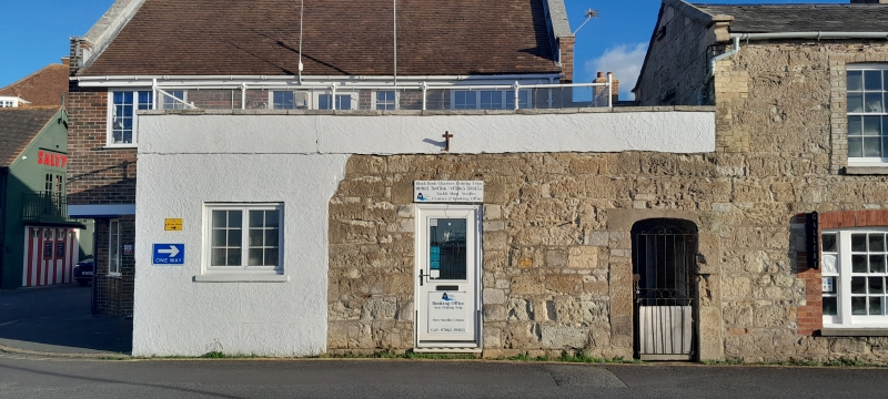
Entry Name: Harold Hayles and H M Custom Front Wall
Listing Date: 28 March 1994
Grade: II
Source: Historic England
Source ID: 1290913
English Heritage Legacy ID: 393252
ID on this website: 101290913
Location: Yarmouth, Isle of Wight, PO41
County: Isle of Wight
Civil Parish: Yarmouth
Built-Up Area: Yarmouth
Traditional County: Hampshire
Lieutenancy Area (Ceremonial County): Isle of Wight
Church of England Parish: Yarmouth St James
Church of England Diocese: Portsmouth
Tagged with: Architectural structure
YARMOUTH
SZ3589 BRIDGE ROAD 1354-0/10/358 Harold Hayles and H.M. Custom Front Wall
II
Wall to former coastguard cottage, now part of office premises. 1837. Wall of coursed stone rubble with 4 centred arched stone entrance to right hand side. Deep stone coping.
Listing NGR: SZ3536489732
External links are from the relevant listing authority and, where applicable, Wikidata. Wikidata IDs may be related buildings as well as this specific building. If you want to add or update a link, you will need to do so by editing the Wikidata entry.


Other nearby listed buildings