Latitude: 51.8178 / 51°49'3"N
Longitude: -1.306 / 1°18'21"W
OS Eastings: 447933
OS Northings: 213466
OS Grid: SP479134
Mapcode National: GBR 7WS.SSG
Mapcode Global: VHCXF.9KXV
Plus Code: 9C3WRM9V+4H
Entry Name: Begbroke Hill Farmhouse
Listing Date: 26 November 1951
Grade: II
Source: Historic England
Source ID: 1291316
English Heritage Legacy ID: 393665
ID on this website: 101291316
Location: Yarnton, Cherwell, Oxfordshire, OX5
County: Oxfordshire
District: Cherwell
Civil Parish: Begbroke
Traditional County: Oxfordshire
Lieutenancy Area (Ceremonial County): Oxfordshire
Church of England Parish: Begbroke
Church of England Diocese: Oxford
Tagged with: Farmhouse
BEGBROKE SANDY LANE SP41SE (North side) 3/1 Begbroke Hill Farmhouse
26/11/51
- II
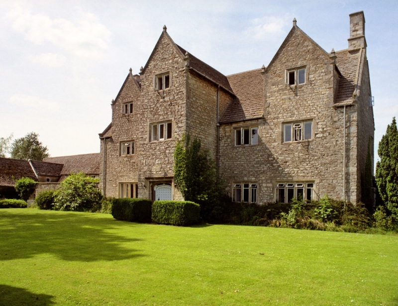
Farmhouse, now offices. c.1604 for Humphrey Fitzherbert. Coursed limestone rubble; gabled artificial stone slate roof with moulded kneelers to stone acoping; stone end stacks. Double-depth plan. Jacobean style. 2 storeys and attic; 5-window range. 3-storey central porch has pyramidal finials to stone-coped gable; 2- and 3-light ovolo-moulded stone-mullioned windows; label mould over chamfered shallow-arched doorway with roundels set in spandrels and C20 door. Similar 3-light and 4-light windows; similar 2-light windows set in gabled dormers to end bays with pyramidal finials to stone-coped gables. Similar windows to sides and rear. C19 rear extension. Early C17 blocked chamfered pointed arch with moulded imposts to C17 cellar to rear right. Interior: porch has plaster quadripartite vaulted ceiling and stop-chamfered segmental-arched doorway. Stone-flag floors, Quartered beams to right, have moulded cornices and trailing scrolls and flowers to soffits of beams and frieze. Stop-chamfered beams to left and first floor. Restored winder stairs to rear right. Moulded and arched stone fireplace with sunk spandrels to first floor room on left. Butt-purlin roof, In 1604 Fitzherbert was accused of ruining nearby roads by the frequent use of "late carriages for his buildings". (Buildings of England: Oxfordshire: p450; Information from the VCH)
Listing NGR: SP4793313466
External links are from the relevant listing authority and, where applicable, Wikidata. Wikidata IDs may be related buildings as well as this specific building. If you want to add or update a link, you will need to do so by editing the Wikidata entry.


Other nearby listed buildings