Latitude: 49.9156 / 49°54'56"N
Longitude: -6.3189 / 6°19'7"W
OS Eastings: 90075
OS Northings: 10651
OS Grid: SV900106
Mapcode National: GBR BXSX.2H4
Mapcode Global: VGYC4.FDB2
Plus Code: 8CXMWM8J+6F
Entry Name: Outer Walls and Gateway
Listing Date: 14 December 1992
Grade: I
Source: Historic England
Source ID: 1291751
English Heritage Legacy ID: 62521
ID on this website: 101291751
Location: Hugh Town, Isles of Scilly, Cornwall, TR21
County: Isles of Scilly
Civil Parish: St. Mary's
Built-Up Area: Hugh town
Lieutenancy Area (Ceremonial County): Cornwall
Church of England Parish: Isles of Scilly
Church of England Diocese: Truro
Tagged with: Wall
ST. MARY'S
SV9010 THE GARRISON, Hugh Town 1358-0/8/82 Outer walls and gateway
GV I
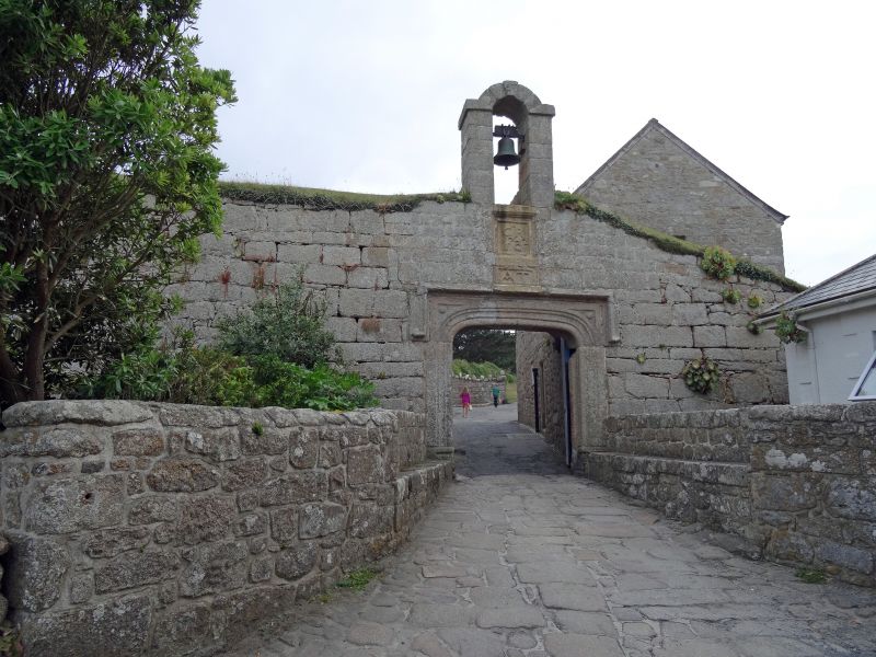
Bastion walls and gateway. Wall and bastions across neck of the Hugh begun by Francis Godolphin soon after 1601; batteries and walls encircling peninsula of 1716-46 by Abraham Tovey, Master Gunner. Turf and granite coping to facing walls of dressed granite, the C18 walls being of particularly well-cut granite. Batteries are mostly angular in plan and are located in large bastions found principally at Morning Point, Woolpack Point and south of Steval Point; embrasures to tops of battery walls and gun emplacements formed by large dressed granite slabs. Stone sentry box with segmental-arched doorway and ball finial to pyramidal roof on rampart to east of gateway. Gateway has label mould over moulded arched doorway with sunk spandrels; C18 bellcote above surmounts plaque with date 1742 and GR monogram above plaque with monogram AT. The C18 batteries are mostly restorations or rebuilds of mid C17 structures, and their construction followed a report on the state of the defences by Colonel Christian Lilley in 1715. Part of an important fortification, centred on Star Castle (qv). Scheduled as an Ancient Monument. (P Laws: The Buildings of Scilly: Redruth: 1980-: 6, 10; B.H. St.J.O'Neil: Isles of Scilly: London (HMSO): 1950-: 26, 31-3; Saunders A: Fortress Britain: Liphook: 1989-: 79-80).
Listing NGR: SV9007510650
External links are from the relevant listing authority and, where applicable, Wikidata. Wikidata IDs may be related buildings as well as this specific building. If you want to add or update a link, you will need to do so by editing the Wikidata entry.


Other nearby listed buildings