Latitude: 54.8919 / 54°53'30"N
Longitude: -2.9322 / 2°55'56"W
OS Eastings: 340303
OS Northings: 555638
OS Grid: NY403556
Mapcode National: GBR 7CYW.Z5
Mapcode Global: WH802.X9WM
Plus Code: 9C6VV3R9+Q4
Entry Name: 1-9, the Crescent
Listing Date: 22 February 1973
Grade: II
Source: Historic England
Source ID: 1291802
English Heritage Legacy ID: 386879
ID on this website: 101291802
Location: Carlisle, Cumberland, Cumbria, CA1
County: Cumberland
District: Carlisle
Parish: Non Civil Parish
Built-Up Area: Carlisle
Traditional County: Cumberland
Lieutenancy Area (Ceremonial County): Cumbria
Church of England Parish: Carlisle St Cuthbert with St Mary
Church of England Diocese: Carlisle
Tagged with: Building
CARLISLE
NY4055NW THE CRESCENT 671-1/12/106 (South East side) 22/02/73 Nos.1-9 (Consecutive)
GV II
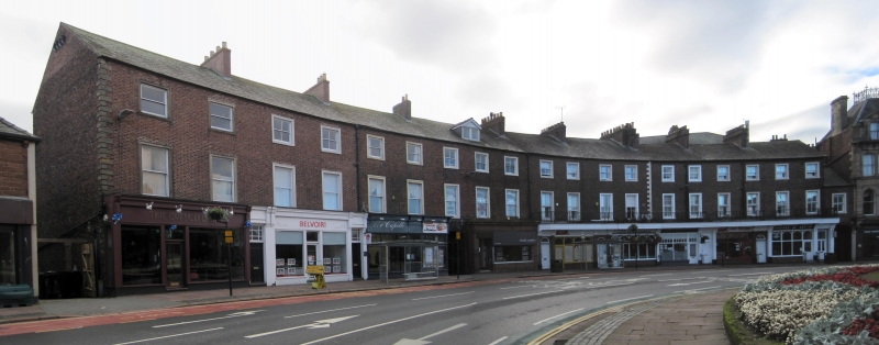
9 houses, now 8 shops with offices above. Early C19 of 2 periods, with later alterations. Flemish bond brickwork, the earliest part with V-jointed quoins, partly painted. Graduated greenslate roof; original ridge brick chimney stacks. Built in two phases; 6 houses and 3 houses divided by quoins. 3 storeys, 2 bays each, except those over through archways which are of 3 bays, all forming one continuous crescent. First phase has central archway in quoined surround. Ground floor is now all C20 shop fronts. Sash windows above in painted stone surrounds and smaller attic windows. Second phase has been made to look identical, but without quoins and has a right archway with brick reveals. INTERIORS not inspected. HISTORY: A tour of the city c1820 mentions the houses in the Crescent. John Woods' Map of Carlisle 1821 shows the first phase complete; newspaper references suggest that the second phase could have been under construction in 1824. An 1870s photograph shows the second phase as only 2 storeys; by 1899 these had been raised to 3 storeys. Perriam (1988) shows a photograph of 1899 showing these buildings when they were private houses. (Perriam DR: Carlisle in Camera: 1988-: P.37).
Listing NGR: NY4030355638
External links are from the relevant listing authority and, where applicable, Wikidata. Wikidata IDs may be related buildings as well as this specific building. If you want to add or update a link, you will need to do so by editing the Wikidata entry.


Other nearby listed buildings