Latitude: 54.5421 / 54°32'31"N
Longitude: -1.924 / 1°55'26"W
OS Eastings: 405013
OS Northings: 516318
OS Grid: NZ050163
Mapcode National: GBR HH0X.7K
Mapcode Global: WHB4L.F318
Plus Code: 9C6WG3RG+R9
Entry Name: 1 and 3, the Bank
Listing Date: 22 February 1973
Last Amended: 28 November 1994
Grade: II
Source: Historic England
Source ID: 1291864
English Heritage Legacy ID: 388806
ID on this website: 101291864
Location: Startforth, County Durham, DL12
County: County Durham
Civil Parish: Barnard Castle
Built-Up Area: Barnard Castle
Traditional County: Durham
Lieutenancy Area (Ceremonial County): County Durham
Church of England Parish: Barnard Castle with Whorlton
Church of England Diocese: Durham
Tagged with: Building
BARNARD CASTLE
NZ0516SW THE BANK 770-1/6/177 (West side) 22/02/73 Nos.1 AND 3 (Formerly Listed as: THE BANK (West side) Nos.1-17, 23-29 (Odd) and The Old Well)
GV II
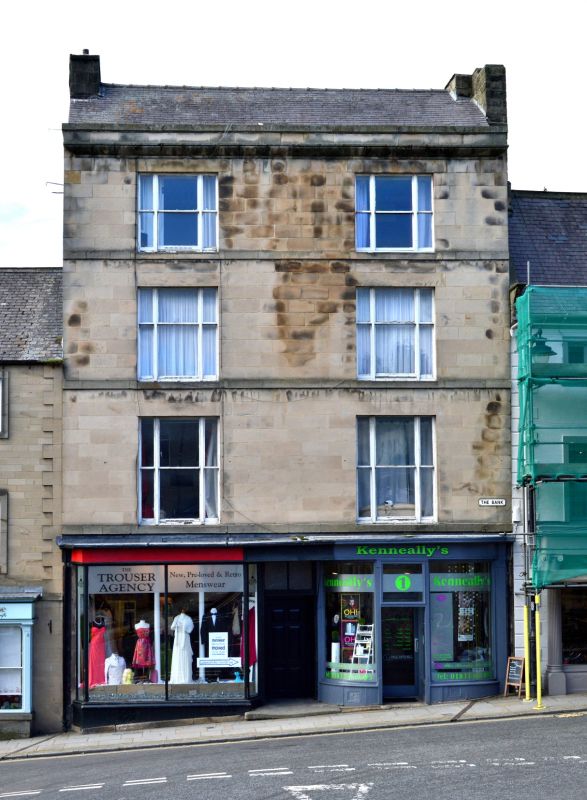
Pair of houses, now 2 shops and flats. Early C19. Ashlar with roof of thin slates, probably synthetic, with stone chimneys. 4 storeys; 2-window range. Central recessed canted entrance to passage door to yard. Flanking shop fronts have plate-glass windows with slender fluted pilasters, the right shop front also with paterae, and low stall-risers, the left with pierced cast-iron grille. Roll moulded cornice on continuous fascia. Left shop entered from door in central passage; right shop has recessed entrance between curved plate-glass. Tripartite sashes in plain reveals on each floor above have sill bands and flat stone lintels. Eaves gutter cornice below low roof parapet. Roof has truncated end chimneys. INTERIOR: not inspected.
Listing NGR: NZ0501316318
External links are from the relevant listing authority and, where applicable, Wikidata. Wikidata IDs may be related buildings as well as this specific building. If you want to add or update a link, you will need to do so by editing the Wikidata entry.


Other nearby listed buildings