Latitude: 53.4339 / 53°26'1"N
Longitude: -2.9674 / 2°58'2"W
OS Eastings: 335825
OS Northings: 393444
OS Grid: SJ358934
Mapcode National: GBR 78C.31
Mapcode Global: WH871.DY5D
Plus Code: 9C5VC2MM+G2
Entry Name: Bandstand in Front of Conservatory
Listing Date: 14 March 1975
Grade: II
Source: Historic England
Source ID: 1292149
English Heritage Legacy ID: 359576
ID on this website: 101292149
Location: Stanley Park, Kirkdale, Liverpool, Merseyside, L4
County: Liverpool
Electoral Ward/Division: Kirkdale
Parish: Non Civil Parish
Built-Up Area: Liverpool
Traditional County: Lancashire
Lieutenancy Area (Ceremonial County): Merseyside
Church of England Parish: Walton Breck Christ Church and Holy Trinity
Church of England Diocese: Liverpool
Tagged with: Bandstand
SJ 3593 STANLEY PARK L4
16/1200 Bandstand in front of conservatory 14.3.75. G.V. II
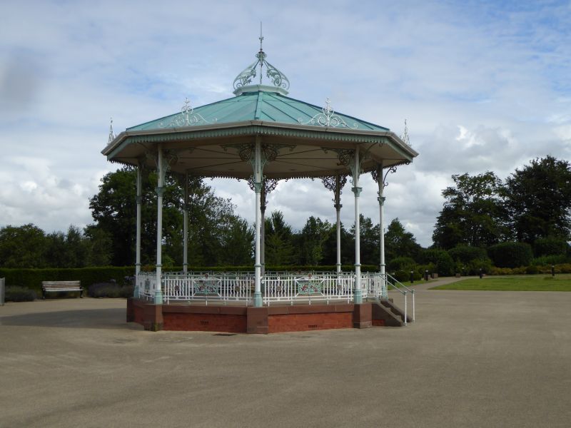
Bandstand. Probably 1870 by Robson. Octagonal roof now felted (1984) with decorative iron crest on its peak, resting on 8 slender iron columns with ornamented arch braces. Open sides. Delicate and decorative.
Listing NGR: SJ3582593444
External links are from the relevant listing authority and, where applicable, Wikidata. Wikidata IDs may be related buildings as well as this specific building. If you want to add or update a link, you will need to do so by editing the Wikidata entry.


Other nearby listed buildings