Latitude: 53.766 / 53°45'57"N
Longitude: -2.6927 / 2°41'33"W
OS Eastings: 354436
OS Northings: 430181
OS Grid: SD544301
Mapcode National: GBR TBZ.0P
Mapcode Global: WH85M.LLZS
Plus Code: 9C5VQ884+9W
Entry Name: Deepdale Hall (Formerly Main Block of Preston Royal Infirmary)
Listing Date: 7 April 1988
Grade: II
Source: Historic England
Source ID: 1292423
English Heritage Legacy ID: 391973
ID on this website: 101292423
Location: Deepdale, Preston, Lancashire, PR1
County: Lancashire
District: Preston
Electoral Ward/Division: St George's
Parish: Non Civil Parish
Built-Up Area: Preston
Traditional County: Lancashire
Lieutenancy Area (Ceremonial County): Lancashire
Church of England Parish: Preston All Saints
Church of England Diocese: Blackburn
Tagged with: Building
PRESTON
SD5430 DEEPDALE ROAD 941-1/5/93 (West side) 07/04/88 Deepdale Hall (formerly main block of Preston Royal Infirmary)
GV II
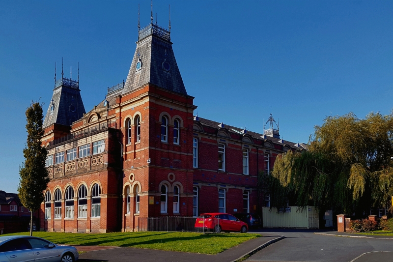
Formerly known as: Preston Royal Infirmary DEEPDALE ROAD. Hospital, now hall of residence. 1829-33; altered and enlarged in C20 (probably 1926). Red brick in Flemish bond with sandstone dressings, rendered dressings to upper floors (roof not visible). Double-pile plan (with various additions to the rear which are not of special interest). Two storeys raised to 4 storeys in C20, 4:3:4 windows, symmetrical, the centre set back; with plinth, sill-bands, cornice over 1st floor with original parapet in centre, cornice and low parapet over 3rd floor. Sashed windows with raised sills and wedge lintels. The centre has a full-width 3-bay colonnaded portico with 1,2,2,1 Roman Doric columns in antis and entablature with cornice and blocking course; a central doorway with eared architrave and part-glazed double doors; over the 1st floor a former parapet with centre tablet inscribed "ROYAL INFIRMARY" flanked by raised lettering "ERECTED AD" "MDCCCXXXIII" (and above this a centrepiece to the upper floors with shield and arms). INTERIOR has Jacobean-style staircase (probably C20). History: built by Poor Law Vestry as House of Recovery, incorporated with Royal Infirmary 1870; closed as hospital 1987. Forms group with original infirmary wing to west (q.v.)
Listing NGR: SD5443630181
External links are from the relevant listing authority and, where applicable, Wikidata. Wikidata IDs may be related buildings as well as this specific building. If you want to add or update a link, you will need to do so by editing the Wikidata entry.


Other nearby listed buildings