Latitude: 54.908 / 54°54'28"N
Longitude: -1.3677 / 1°22'3"W
OS Eastings: 440637
OS Northings: 557214
OS Grid: NZ406572
Mapcode National: GBR VFT.93
Mapcode Global: WHD55.YWWV
Plus Code: 9C6WWJ5J+5W
Entry Name: Caretaker's Cottage to Church of Holy Trinity and Attached Wall
Listing Date: 10 November 1978
Last Amended: 17 October 1994
Grade: II
Source: Historic England
Source ID: 1293305
English Heritage Legacy ID: 391424
ID on this website: 101293305
Location: Sunderland, Tyne and Wear, SR1
County: Sunderland
Electoral Ward/Division: Hendon
Parish: Non Civil Parish
Built-Up Area: Sunderland
Traditional County: Durham
Lieutenancy Area (Ceremonial County): Tyne and Wear
Church of England Parish: Hendon
Church of England Diocese: Durham
Tagged with: Cottage
SUNDERLAND
NZ4057 CHURCH WALK 920-1/12/47 (South side) 10/11/78 Caretaker's cottage to Church of Holy Trinity and attached wall (Formerly Listed as: CHURCH WALK (South side) Caretaker's Cottage to Church of Holy Trinity)
GV II
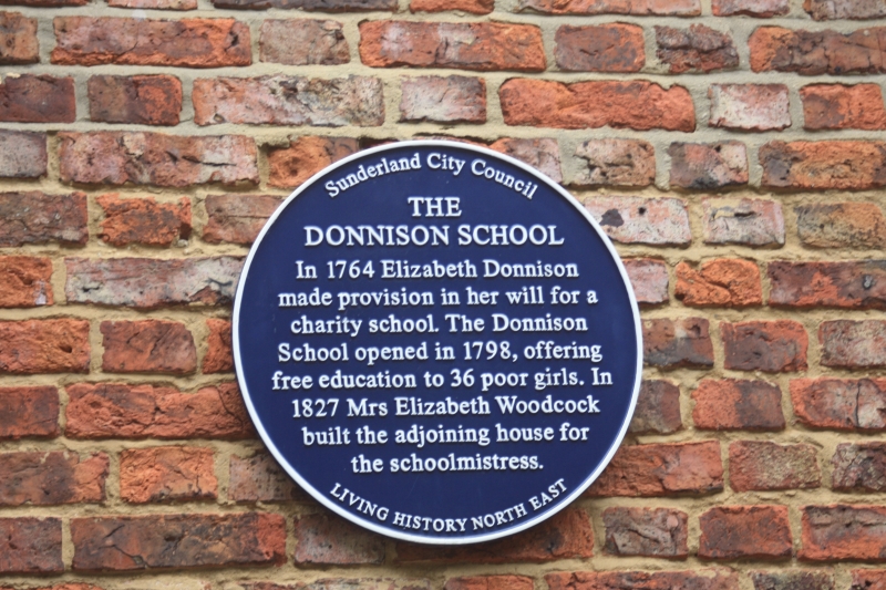
Formerly Donnison school and school-mistress' house; now cottage for caretaker of Holy Trinity Church, with wall attached at left. 1798 on this site, founded under Mrs. Elizabeth Donnison's will of 1764; extended 1827 at expense of Mrs. Elizabeth Woodcock by addition of a house for a school-mistress. Narrow brick, Flemish bond; painted ashlar dressings; slate roof. Flemish bond brick wall with stone coping breaks forward from left and joins yard wall along street. One storey, 3:4 bays. First build at right has plinth and impost band to blank arcade and recessed left door surround, with gauged brick arches. Top blocking course and raised panel above 4-panelled door with patterned overlight; THE DONNISON SCHOOL in top panel in low-relief letters. Low-pitched hipped roof. Left building has similar door in round-headed surround with gauged brick arch in projecting right entrance bay on plinth; impost band to two left bays with gauged brick round arches over fixed lights with glazing bars. Low-relief BOYS in panel over door. Top blocking course. Low-pitched hipped roof with tall left brick chimney-stack. Stone-coped wall set back at left has blocked opening with projecting stone sill and breaks forward with stepped stone coping to wall and to tall brick pier on street front, returning along street front in later bond for one bay containing blocked opening under flat stone lintel.
Listing NGR: NZ4063757214
External links are from the relevant listing authority and, where applicable, Wikidata. Wikidata IDs may be related buildings as well as this specific building. If you want to add or update a link, you will need to do so by editing the Wikidata entry.


Other nearby listed buildings