Latitude: 50.8584 / 50°51'30"N
Longitude: 0.5903 / 0°35'25"E
OS Eastings: 582404
OS Northings: 109739
OS Grid: TQ824097
Mapcode National: GBR QYP.02S
Mapcode Global: FRA D63T.ZRG
Plus Code: 9F22VH5R+94
Entry Name: Number 55 (Darlington House) and Numbers 57 and 59 and Garden Wall in Front of Nos 55, 57 and 59
Listing Date: 19 January 1951
Grade: II
Source: Historic England
Source ID: 1293591
English Heritage Legacy ID: 293777
ID on this website: 101293591
Location: West Hill, Hastings, East Sussex, TN34
County: East Sussex
District: Hastings
Electoral Ward/Division: Old Hastings
Parish: Non Civil Parish
Built-Up Area: Hastings
Traditional County: Sussex
Lieutenancy Area (Ceremonial County): East Sussex
Church of England Parish: Hastings St Clement and All Saints
Church of England Diocese: Chichester
Tagged with: Architectural structure
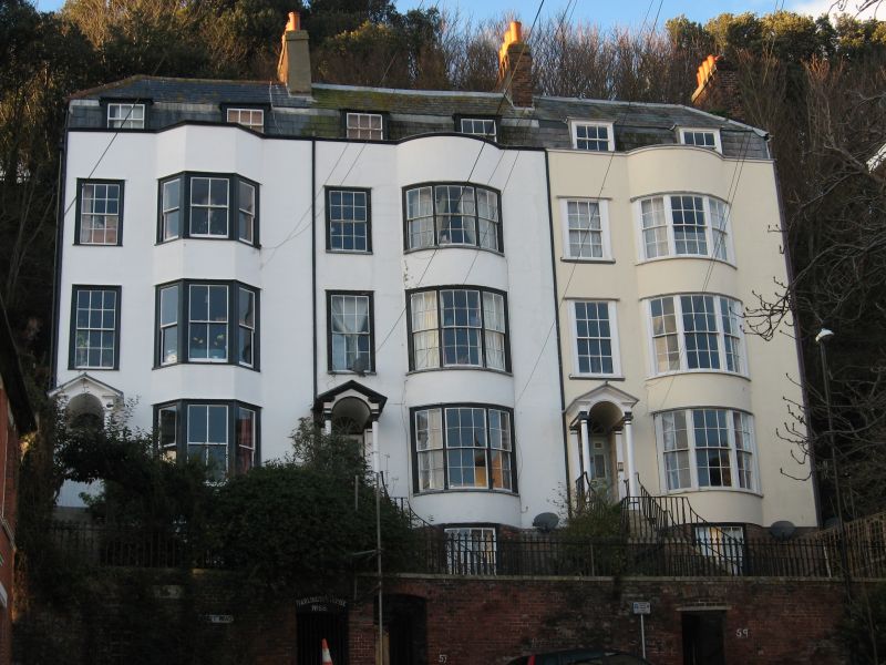
CROFT ROAD 1. 5204 (West Side) 19.1.51. No 55 (Darlington House) Nos 57 and 59. - Garden wall in front of Nos 55, 57 and 59 TQ 8209 NW 7/111 II 2. 1817. A terrace originally called Gloucester Place. Stuccoed. Parapet. Slate mansard with half-hipped ends. 4 storeys, attic and basement. Each house has arched and open pedimented porch on Tuscan columns, traceried fanlight and panelled doors, and each has a sash window with glazing bars and segmental bowed bay window of sashes with glazing bars, on each floor. No 55 has 3-storeyed canted bay with sashes without glazing bars in place of original bowed window. Square-roofed dormers with sashes with glazing bars. Along flight of steps to each doorway with iron railings with turned newels. The terrace is built high above road with gardens on red brick terrace wall with iron railings with arrow-head shafts.
Listing NGR: TQ8240409739
External links are from the relevant listing authority and, where applicable, Wikidata. Wikidata IDs may be related buildings as well as this specific building. If you want to add or update a link, you will need to do so by editing the Wikidata entry.


Other nearby listed buildings