Approximate Location Map
Large Map »
Latitude: 52.6165 / 52°36'59"N
Longitude: -0.906 / 0°54'21"W
OS Eastings: 474167
OS Northings: 302646
OS Grid: SK741026
Mapcode National: GBR BQL.ZQW
Mapcode Global: WHFKS.1HVG
Plus Code: 9C4XJ38V+JJ
Entry Name: Skeffington Hall Wall to Churchyard
Listing Date: 24 January 1985
Grade: II
Source: Historic England
Source ID: 1295166
English Heritage Legacy ID: 190616
ID on this website: 101295166
Location: Skeffington, Harborough, Leicestershire, LE7
County: Leicestershire
District: Harborough
Civil Parish: Skeffington
Traditional County: Leicestershire
Lieutenancy Area (Ceremonial County): Leicestershire
Church of England Parish: Skeffington St Thomas Becket
Church of England Diocese: Leicester
Tagged with: Architectural structure
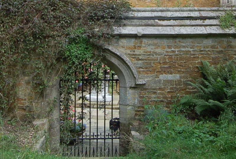
SKEFFINGTON
SK 70 SW MAIN STREET (North Side)
4/88 Skeffington Hall: Wall to
Churchyard
GV II
Length of wall. Probably C17. Coursed rubble with raking ashlar coping, and
incorporating a small archway to churchyard.
Listing NGR: SK7416702646
External links are from the relevant listing authority and, where applicable, Wikidata. Wikidata IDs may be related buildings as well as this specific building. If you want to add or update a link, you will need to do so by editing the Wikidata entry.


Other nearby listed buildings
