Latitude: 52.9703 / 52°58'13"N
Longitude: -2.6847 / 2°41'5"W
OS Eastings: 354111
OS Northings: 341655
OS Grid: SJ541416
Mapcode National: GBR 7L.JVRZ
Mapcode Global: WH89H.QLRS
Plus Code: 9C4VX8C8+44
Entry Name: 41-45, High Street
Listing Date: 1 March 1988
Grade: II
Source: Historic England
Source ID: 1295176
English Heritage Legacy ID: 260649
ID on this website: 101295176
Location: Whitchurch, Shropshire, SY13
County: Shropshire
Civil Parish: Whitchurch Urban
Built-Up Area: Whitchurch
Traditional County: Shropshire
Lieutenancy Area (Ceremonial County): Shropshire
Church of England Parish: Whitchurch St Alkmund
Church of England Diocese: Lichfield
Tagged with: Building
WHITCHURCH URBAN C.P. HIGH STREET (north-east SJ 5441 side) 8/93 Nos. 41 to 45 (odd) - GV II
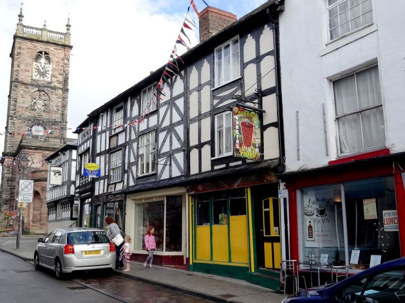
Row of 3 houses, now shops and flats. Mid-to late C17, with early C19 alterations and remodelled in the late C19. Rendered timber frame; C19 planted timbers to front with plaster infill. Slate roof. 3 framed bays. 3 storeys. Brick ridge stack off-centre to left and integral brick end stack to right. 3 bays; early C19 glazing bar sashes to left (20-pane to first floor and 16-pane to second floor) and 2 bays of 3-light C19 wooden casements to right. Three early to mid-C19 wooden shop-fronts with reeded and panelled pilaster strips, Fluted Doric quarter columns flanking door to right, and later plate-glass windows and hair-glazed panelled doors. Interiors not fully inspected but chamfered ceiling beams noted in ground-floor front rooms. This range might have formerly been one house or it might be an early example of a planned terraced range incorporating living accommodation above ground-floor shops.
Listing NGR: SJ5411041657
External links are from the relevant listing authority and, where applicable, Wikidata. Wikidata IDs may be related buildings as well as this specific building. If you want to add or update a link, you will need to do so by editing the Wikidata entry.
Other nearby listed buildings