Approximate Location Map
Large Map »
Latitude: 51.182 / 51°10'55"N
Longitude: -3.4462 / 3°26'46"W
OS Eastings: 299010
OS Northings: 143528
OS Grid: SS990435
Mapcode National: GBR LK.5YJY
Mapcode Global: VH6GM.6KY6
Plus Code: 9C3R5HJ3+RG
Entry Name: 9, West Street
Listing Date: 22 May 1969
Grade: II
Source: Historic England
Source ID: 1296191
English Heritage Legacy ID: 264723
ID on this website: 101296191
Location: Dunster, Somerset, TA24
County: Somerset
District: Somerset West and Taunton
Civil Parish: Dunster
Built-Up Area: Dunster
Traditional County: Somerset
Lieutenancy Area (Ceremonial County): Somerset
Tagged with: Building
1.
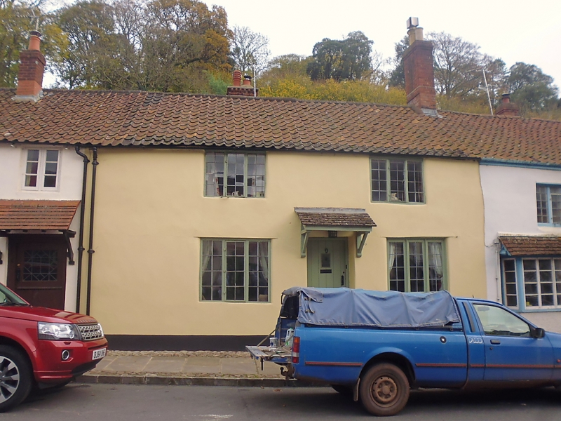
5366 DUNSTER WEST STREET
(East Side)
No 9
SS 9843-9943 4/90 22.5.69
II GV
2.
18th century frontage. Colourwashed rendering, pantiles, brick stacks. Two storeys.
Four 3-light metal casements in wooden frames, leaded lights. Central plain boarded
door.
Listing NGR: SS9901243530
External links are from the relevant listing authority and, where applicable, Wikidata. Wikidata IDs may be related buildings as well as this specific building. If you want to add or update a link, you will need to do so by editing the Wikidata entry.


Other nearby listed buildings
