Latitude: 50.9448 / 50°56'41"N
Longitude: -2.6363 / 2°38'10"W
OS Eastings: 355392
OS Northings: 116344
OS Grid: ST553163
Mapcode National: GBR MN.NZW4
Mapcode Global: FRA 56CM.2R8
Plus Code: 9C2VW9V7+WF
Entry Name: Kingston House and North-East Boundary Wall and Gateway
Listing Date: 17 October 1983
Grade: II
Source: Historic England
Source ID: 1296333
English Heritage Legacy ID: 261384
ID on this website: 101296333
Location: Yeovil, Somerset, BA20
County: Somerset
District: South Somerset
Civil Parish: Yeovil
Built-Up Area: Yeovil
Traditional County: Somerset
Lieutenancy Area (Ceremonial County): Somerset
Tagged with: Architectural structure
ST51NE YEOVIL CP KINGSTON (West side)
2/47 No 14 (Kingston House) and North-east boundary wall and gateway
-
- II
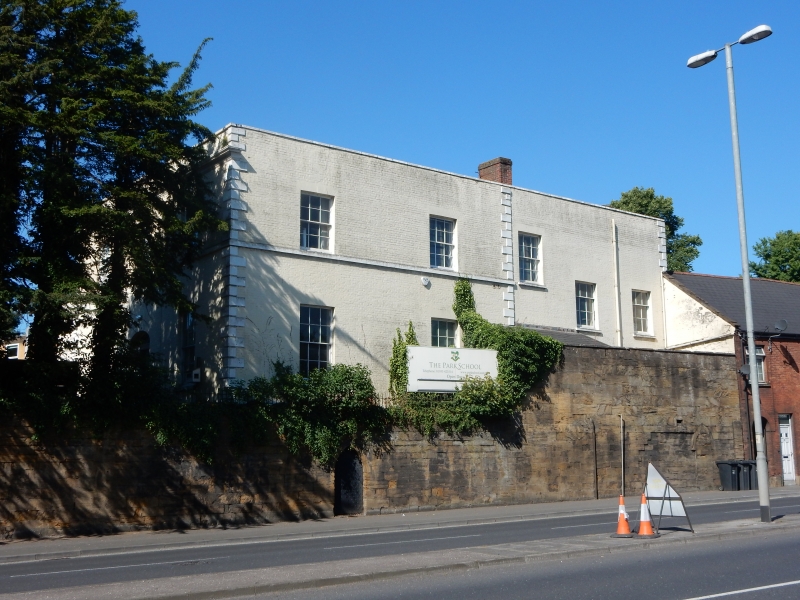
Town house (now private school) of c1840. Brick with Ham stone plinth, band and rusticated quoins: Welsh slated roof behind parapets with stare urns mounted on the four corners. The South East entrance facade 2-storeys of 3-bays, with central 6-pane (4-glazed) door set in simple opening, with 12-pane sash windows each side; these shielded by wood and corrugated iron verandah across whole front, arcaded with bell hipped roof; at first floor level three 12-pane windows in simple openings, fitted with hinged venetian shutters. The South Western return, rendered, matches the first floor in its 2-bays, but at ground floor level there is a single storey stone and rendered extension, with an angled bay window. The interior not seen. The extension to South West not included in the listing. To the North Eastern boundary a high capped stone wall with two 2-centre arched openings (one blocked) and panelled and capped gate piers (trio left-hand cap now missing).
Listing NGR: ST5539216344
External links are from the relevant listing authority and, where applicable, Wikidata. Wikidata IDs may be related buildings as well as this specific building. If you want to add or update a link, you will need to do so by editing the Wikidata entry.


Other nearby listed buildings