Latitude: 51.2303 / 51°13'48"N
Longitude: -2.326 / 2°19'33"W
OS Eastings: 377335
OS Northings: 147947
OS Grid: ST773479
Mapcode National: GBR 0S9.SW8
Mapcode Global: VH97D.MBQQ
Plus Code: 9C3V6MJF+4J
Entry Name: The Packhorse Inn
Listing Date: 22 July 1949
Grade: II
Source: Historic England
Source ID: 1296469
English Heritage Legacy ID: 266133
ID on this website: 101296469
Location: Frome, Somerset, BA11
County: Somerset
District: Mendip
Civil Parish: Frome
Built-Up Area: Frome
Traditional County: Somerset
Lieutenancy Area (Ceremonial County): Somerset
Tagged with: Inn
1. 5363 CHRISTCHURCH STREET WEST (North-East side)
GV No 13 and No 14 (The ST 7747 NW 9/50 22.7.49 Packhorse Inn)
II
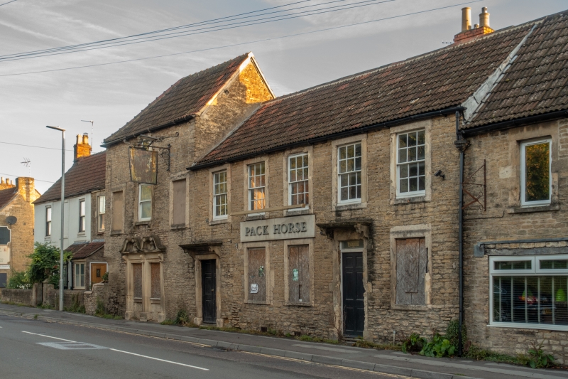
2. No 13 early, No 14 mid-C18. 2 storey rubble with pantile roofs. No 13 has 2 left hand bays set back and a projecting 2½ storey part hipped extension to right, to which No 14 is an extension. No 13 has 2 1st floor bolection surround windows to left and two similar with cornices on ground floor of projecting extension. Above the latter are windows with raised surrounds (ogee moulded outer edges) similar to No 14. Right hand part of No 13 has a small window on 2nd floor, 3 windows on 1st floor, outer 2 blind, the centre a C19 sash in architrave surround with cornice. Paired doorways below (now with C19 sashes), architrave surrounds, broken serpentine pediments over containing carved urns - a local Mannerist feature. No 14 is lower, 2 storeys, 5 windows, with glazing bar sashes on 1st floor, raised surrounds (outer edges with ogee mould). 2 doorways on ground floor, left hand one with raised outer moulded surround and cut brackets to moulded flat hood.
Listing NGR: ST7733547947
External links are from the relevant listing authority and, where applicable, Wikidata. Wikidata IDs may be related buildings as well as this specific building. If you want to add or update a link, you will need to do so by editing the Wikidata entry.


Other nearby listed buildings