Latitude: 51.0629 / 51°3'46"N
Longitude: -1.3168 / 1°19'0"W
OS Eastings: 447970
OS Northings: 129511
OS Grid: SU479295
Mapcode National: GBR 861.9WY
Mapcode Global: FRA 8649.LV8
Plus Code: 9C3W3M7M+57
Entry Name: 64, High Street
Listing Date: 14 January 1974
Grade: II
Source: Historic England
Source ID: 1296576
English Heritage Legacy ID: 144607
ID on this website: 101296576
Location: Winchester, Hampshire, SO23
County: Hampshire
District: Winchester
Electoral Ward/Division: St Michael
Parish: Non Civil Parish
Built-Up Area: Winchester
Traditional County: Hampshire
Lieutenancy Area (Ceremonial County): Hampshire
Church of England Parish: Winchester St Lawrence with St Swithun-upon-Kingsgate
Church of England Diocese: Winchester
Tagged with: Building
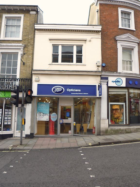
1.
1833 HIGH STREET
(South Side)
No 64
SU 4729 NE 2/102B
II GV
2.
Late C18. Stucco. Two storeys, one three.light window with cornice.
Modern shop front. Dentil cornice, hipped tile roof.
The listed buildings from No 57 to NO 64A form a group.
Listing NGR: SU4796829506
External links are from the relevant listing authority and, where applicable, Wikidata. Wikidata IDs may be related buildings as well as this specific building. If you want to add or update a link, you will need to do so by editing the Wikidata entry.


Other nearby listed buildings