Latitude: 52.3164 / 52°18'59"N
Longitude: -1.9941 / 1°59'38"W
OS Eastings: 400501
OS Northings: 268702
OS Grid: SP005687
Mapcode National: GBR 2G7.LPS
Mapcode Global: VH9ZT.D15K
Plus Code: 9C4W8284+H9
Entry Name: Water Tower About 300 Metres South of Hewell Grange
Listing Date: 16 July 1986
Grade: II
Source: Historic England
Source ID: 1296648
English Heritage Legacy ID: 156221
ID on this website: 101296648
Location: Tardebigge, Bromsgrove, Worcestershire, B97
County: Worcestershire
District: Bromsgrove
Civil Parish: Tutnall and Cobley
Traditional County: Worcestershire
Lieutenancy Area (Ceremonial County): Worcestershire
Church of England Parish: Tardebigge
Church of England Diocese: Worcester
Tagged with: Water tower
SP 06 NW TUTNALL & COBLEY CP HEWELL PARK
10/169 Water tower about 300 metres south of Hewell Grange
- II
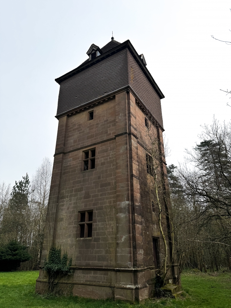
Water tower. Late C19, probably by Bodley and Garner. Sandstone ashlar with pyramidal shingle roof. Square plan, four storeys high divided by string courses, with pilaster buttresses to corners; attic lit by gabled dormers, top storey blind with shingle cladding to water tank; ground and first floors have a stone cross window; second storey has a small square-headed window to each storey. The tower is in a prominent location, at the head of a series of grass steps leading up from the French Garden.
Listing NGR: SP0050168702
External links are from the relevant listing authority and, where applicable, Wikidata. Wikidata IDs may be related buildings as well as this specific building. If you want to add or update a link, you will need to do so by editing the Wikidata entry.


Other nearby listed buildings