Latitude: 53.9858 / 53°59'8"N
Longitude: -2.1072 / 2°6'25"W
OS Eastings: 393068
OS Northings: 454425
OS Grid: SD930544
Mapcode National: GBR FQQB.LY
Mapcode Global: WHB76.L2SQ
Plus Code: 9C5VXVPV+84
Entry Name: Higher Land House and Attached Barn
Listing Date: 31 May 1989
Grade: II
Source: Historic England
Source ID: 1296697
English Heritage Legacy ID: 324970
ID on this website: 101296697
Location: Gargrave, North Yorkshire, BD23
County: North Yorkshire
District: Craven
Civil Parish: Gargrave
Built-Up Area: Gargrave
Traditional County: Yorkshire
Lieutenancy Area (Ceremonial County): North Yorkshire
Church of England Parish: Gargrave St Andrew
Church of England Diocese: Leeds
Tagged with: Architectural structure
GARGRAVE WEST STREET SD 9354 6/76 Higher Land House and attached barn GV
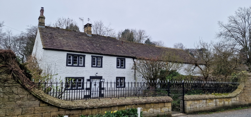
House and attached barn, late C18. Coursed rubble and stone slate roof. Two storeys and three bays to the house. Quoins. Central doorway with large stones to the joints. The windows all have recessed square mullions; the left hand bay has three lights to each, the remainder have two. The barn is an addition but not much younger, with segmental cart entry in rubble.
Listing NGR: SD9306754426
External links are from the relevant listing authority and, where applicable, Wikidata. Wikidata IDs may be related buildings as well as this specific building. If you want to add or update a link, you will need to do so by editing the Wikidata entry.


Other nearby listed buildings