Latitude: 53.5971 / 53°35'49"N
Longitude: -2.831 / 2°49'51"W
OS Eastings: 345101
OS Northings: 411491
OS Grid: SD451114
Mapcode National: GBR 8VNV.W8
Mapcode Global: WH86B.HV48
Plus Code: 9C5VH5W9+RJ
Entry Name: Junction Bridge Canal Basin and Former Dry Dock, Top Locks (That Part in Lathom) Leeds and Liverpool Canal Junction Bridge Canal Basin and Former Dry Dock, Top Locks (That Part in Burscough)
Listing Date: 1 March 1993
Grade: II
Source: Historic England
Source ID: 1297530
English Heritage Legacy ID: 386319
ID on this website: 101297530
Location: Ring o' Bells, West Lancashire, L40
County: Lancashire
District: West Lancashire
Civil Parish: Burscough
Built-Up Area: Burscough
Traditional County: Lancashire
Lieutenancy Area (Ceremonial County): Lancashire
Church of England Parish: Burscough Bridge St John
Church of England Diocese: Liverpool
Tagged with: Canal basin
LATHOM
SD41SE WHEAT LANE 663-1/3/81 (West side (off)) Junction Bridge canal basin & former dry dock, Top Locks (that part Lathom CP)
GV II
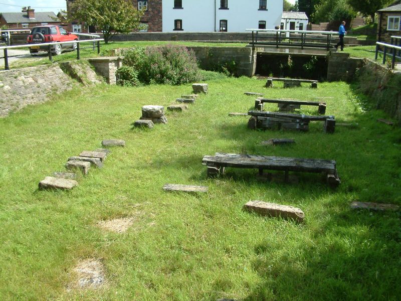
Includes: Junction Bridge canal basin & fmr. dry dock, Top Locks (that part Burscough CP) LEEDS-LIVERPOOL CANAL BURSCOUGH. Canal basin and dry dock. c.1781. Resident engineer Richard Owen. For the Leeds-Liverpool Canal Company. Coursed sandstone blocks, and coursed sandstone rubble, respectively. The BASIN forms the inner entrance to the Rufford Branch Canal, leading to the upper of the two Top Locks. The east side is straight, with a narrow flagged footpath against the towpath wall, which is of coursed squared sandstone with a rounded coping; the west side is in 2 convex sections, forming a curved funnelled entrance to the dry dock. The DRY DOCK, which is at right-angles to the basin, has an entrance gate composed of massive wooden beams slotted into the side walls, a straight south wall (parallel to the main line of the Leeds-Liverpool canal), and a curved and sloped north side, with one flight of steps down at the east end of this side and another in the west end wall; and the floor of the dock has a set of 6 wooden trestles to support the boats (apparently restored). Forms the central element in the group of canal structures at Top Locks. Located on boundary between Burscough CP and Lathom CP.
Listing NGR: SD4510111491
External links are from the relevant listing authority and, where applicable, Wikidata. Wikidata IDs may be related buildings as well as this specific building. If you want to add or update a link, you will need to do so by editing the Wikidata entry.


Other nearby listed buildings