Latitude: 53.7373 / 53°44'14"N
Longitude: -2.9783 / 2°58'41"W
OS Eastings: 335564
OS Northings: 427210
OS Grid: SD355272
Mapcode National: GBR 7TN7.00
Mapcode Global: WH85P.7B08
Plus Code: 9C5VP2PC+WM
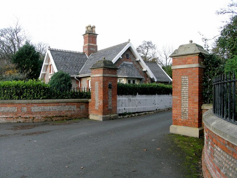
Entry Name: Gate Piers and Quadrant Walls Adjoining to Church Lodge
Listing Date: 13 January 1971
Last Amended: 15 February 1993
Grade: II
Source: Historic England
Source ID: 1297683
English Heritage Legacy ID: 385253
ID on this website: 101297683
Location: Fylde, Lancashire, FY8
County: Lancashire
District: Fylde
Electoral Ward/Division: Ansdell
Parish: Ansdell
Built-Up Area: Lytham St Anne's
Traditional County: Lancashire
Lieutenancy Area (Ceremonial County): Lancashire
Church of England Parish: Lytham St Cuthbert
Church of England Diocese: Blackburn
Tagged with: Gatepost
LYTHAM ST ANNES
SD32NE CHURCH ROAD, Lytham 621-1/3/38 (North side) 13/01/71 Gate piers and quadrant walls adjoining to Church Lodge (Formerly Listed as: LYTHAM Gateway adjoining to Church Lodge)
GV II
Gate piers with linking quadrant walls at entrance to former drive to Lytham Hall Park. Probably mid C19. Red brick with cobble panels and stone dressings. An inner pair of piers, each approx. 1 metre square and 3 metres high, with stone plinth, a narrow vertical panel of inlaid cobble in the centre of each side, a weathered stone band near the top, and moulded stone cap. Convex quadrant walls approx. 1 metre high with long horizontal panels punctuated with small square panels, and chamfered coping with stubs of former iron railings; terminal piers like the main pair. Forms group with Church Lodge (q.v.).
Listing NGR: SD3556427210
External links are from the relevant listing authority and, where applicable, Wikidata. Wikidata IDs may be related buildings as well as this specific building. If you want to add or update a link, you will need to do so by editing the Wikidata entry.


Other nearby listed buildings