Approximate Location Map
Large Map »
Latitude: 52.7515 / 52°45'5"N
Longitude: 0.401 / 0°24'3"E
OS Eastings: 562143
OS Northings: 319799
OS Grid: TF621197
Mapcode National: GBR N3R.D74
Mapcode Global: WHJP7.436G
Plus Code: 9F42QC22+H9
Entry Name: Ruins of St James' Chapel
Listing Date: 1 December 1951
Last Amended: 26 July 1993
Grade: II
Source: Historic England
Source ID: 1298188
English Heritage Legacy ID: 384096
ID on this website: 101298188
Location: St James' End, King's Lynn and West Norfolk, Norfolk, PE30
County: Norfolk
District: King's Lynn and West Norfolk
Electoral Ward/Division: St Margarets with St Nicholas
Parish: Non Civil Parish
Built-Up Area: King's Lynn
Traditional County: Norfolk
Lieutenancy Area (Ceremonial County): Norfolk
Tagged with: Chapel
KING'S LYNN
TF6219NW COUNTY COURT ROAD
610-1/10/40 (West side)
01/12/51 Ruins of St James' Chapel
(Formerly Listed as:
COUNTY COURT ROAD
Remains of St.James' Chapel (at rear
of London Road Methodist Church))
GV II
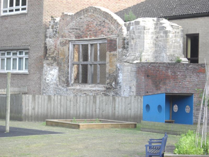
Ruins of Chapel of St.James. Founded before 1146, nave
demolished 1548, extensively robbed 1559 leaving crossing and
one bay of chancel which were converted to workhouse by the
Council 1580. Workhouse ruinous by 1680, rebuilt 1681 possibly
to designs of Henry Bell who was on the supervising committee.
Central bay and tower collapsed 1854, then used for industry
until demolished 1910. Original plan along Mendicant lines:
nave, chancel and central octagonal tower over passageway.
Brick core with limestone facing. No roof. West end is ruin of
cruciform crossing pier with a set-off. East pier without
ashlar facing. Between them is a brick infill pierced by a
4-light timber mullioned window with transom, probably of
1680.
Listing NGR: TF6214319799
External links are from the relevant listing authority and, where applicable, Wikidata. Wikidata IDs may be related buildings as well as this specific building. If you want to add or update a link, you will need to do so by editing the Wikidata entry.


Other nearby listed buildings
