Latitude: 50.3976 / 50°23'51"N
Longitude: -3.5426 / 3°32'33"W
OS Eastings: 290457
OS Northings: 56440
OS Grid: SX904564
Mapcode National: GBR QW.1FFB
Mapcode Global: FRA 37GZ.XB4
Plus Code: 9C2R9FX4+2X
Entry Name: Farm Building South West of Churston Court Farmhouse, Including Gate Piers and Wall
Listing Date: 10 January 1975
Last Amended: 18 October 1993
Grade: II
Source: Historic England
Source ID: 1298281
English Heritage Legacy ID: 383571
ID on this website: 101298281
Location: Churston Ferrers, Torbay, Devon, TQ5
County: Torbay
Electoral Ward/Division: Churston-with-Galmpton
Parish: Non Civil Parish
Traditional County: Devon
Lieutenancy Area (Ceremonial County): Devon
Church of England Parish: Churston Ferrers St Mary the Virgin
Church of England Diocese: Exeter
Tagged with: Agricultural structure
BRIXHAM
SX9056 CHURCH ROAD, Churston Ferrers
1946-1/5/62 (East side)
10/01/75 Farm buildings SW of Churston Court
Farmhouse, including gate piers and
wall
(Formerly Listed as:
CHURSTON ROAD, Churston Ferrers
Range of outbuildings to Churston
Court Farm along road)
GV II
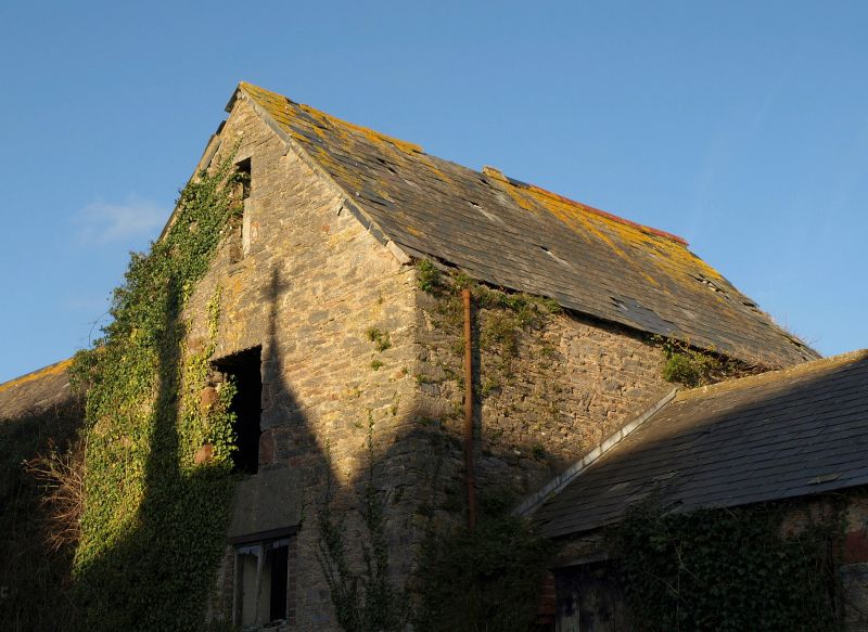
Enclosed courtyard containing shippons, stables, root house,
granary, pound house and cart shed. Mid C19. Stone rubble with
some red sandstone. Slated roofs.
Plan: U-shaped range with walled courtyard on north-east.
Range to north-west contained stables and cider store with
lofts, wool-chamber and granary over; the upper storey reached
by 2 flights of stone steps. South-west range contained lofted
shippons with root house to north-west, projecting along
Churston Road outside the courtyard. South-east range has
pound house adjoining road and, nearest the house, an
open-fronted cart shed and trap house with its back to the
enclosed yard.
Exterior: stable range has distinct architectural quality,
with gabled centre projection having red sandstone quoins. 2
doorways in ground storey and a loading door above, all with
slightly curved arches of voussoirs and jamb-stones
alternately of limestone and sandstone. In the gable a
ventilation slit with similar jambs. At either side, one
window of similar character on each side, these in turn
flanked by recessed sections containing stone staircases. At
right-hand end a gabled projection similar to the rest with
former cider store in ground storey and granary above. Next to
it, at head of steps, was the wool chamber. Shippon range in
same style with gabled projection at left-hand end.
Immediately left of this again is one end of the pound house,
with entrance to the apple loft. The pound house, which
projects slightly to the south-east, matches the stables and
shippon in its elevation to Churston Road. Abutting its
south-east gable wall is a square gate pier with low pyramidal
cap, forming one side of the original entrance to the
farmstead. Cart shed has 2 stone walls faced with red
sandstone and 3 red brick piers, the latter probably late C19
replacements.
INTERIORS: little original detail survives. The overhead
fittings for the apple-crusher remain in the pound house, and
one wooden partition in the stables.
Subsidiary features: Courtyard wall has chamfered coping of
stones on edge. 2 square gate piers, that to right retaining
its low pyramidal cap. Several staddle-stones used as garden
ornaments are said to have come from a rickyard placed, not
behind the barn, but at the opposite end of the farmstead,
behind the stables.
Listing NGR: SX9045756440
External links are from the relevant listing authority and, where applicable, Wikidata. Wikidata IDs may be related buildings as well as this specific building. If you want to add or update a link, you will need to do so by editing the Wikidata entry.


Other nearby listed buildings