Latitude: 50.8499 / 50°50'59"N
Longitude: -0.2073 / 0°12'26"W
OS Eastings: 526291
OS Northings: 107129
OS Grid: TQ262071
Mapcode National: GBR JNN.NDC
Mapcode Global: FRA B6GV.F1M
Plus Code: 9C2XRQXV+X3
Entry Name: Benfield Barn
Listing Date: 29 August 1973
Last Amended: 2 November 1992
Grade: II
Source: Historic England
Source ID: 1298634
English Heritage Legacy ID: 365537
ID on this website: 101298634
Location: Benfield Valley Golf Course, Hangleton, Brighton and Hove, West Sussex, BN3
County: The City of Brighton and Hove
Electoral Ward/Division: Hangleton and Knoll
Parish: Non Civil Parish
Built-Up Area: Brighton and Hove
Traditional County: Sussex
Lieutenancy Area (Ceremonial County): East Sussex
Church of England Parish: Hangleton St Helen
Church of England Diocese: Chichester
Tagged with: Barn
HOVE
TQ20NW HANGLETON LANE, Hangleton 579-1/3/155 (North side) 29/08/73 Benfield Barn (Formerly Listed as: Former Benfield Farm Barn facing west Hove Golf Course)
II
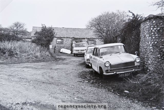
Barn. Probably C18. Coursed flint pebbles with red brick dressings and quoins, clay tiled roof. Plan: wagon entrances centre east and west fronts, outshuts under catslide roofs north-east and south-east, remains of three small single cell structures at south gable end. Gable ends with ventilation slits, square opening below eaves north-west corner, boarded up with corrugated-iron sheeting, timber post visible on facade to left of entrance, cast-iron sheeting to former double doors of wagon entrance, tiles missing from sections of outshuts; gable ends and much of facade obscured by vegetation at time of survey. Interior not accessible, said to have a queen post roof. The barn was part of the farm at Benfield Manorhouse, built early C17 and demolished 1871 when the range of cottages to the south (not included) was constructed. Further farm buildings of interest may survive beneath dense vegetation to east.
Listing NGR: TQ2629107129
External links are from the relevant listing authority and, where applicable, Wikidata. Wikidata IDs may be related buildings as well as this specific building. If you want to add or update a link, you will need to do so by editing the Wikidata entry.


Other nearby listed buildings