Latitude: 51.4615 / 51°27'41"N
Longitude: -2.5957 / 2°35'44"W
OS Eastings: 358712
OS Northings: 173784
OS Grid: ST587737
Mapcode National: GBR C7G.XY
Mapcode Global: VH88M.YJMG
Plus Code: 9C3VFC63+JP
Entry Name: Number 25 and Attached Front Area Walls, Piers and Railings
Listing Date: 13 December 1973
Last Amended: 30 December 1994
Grade: II
Source: Historic England
Source ID: 1298851
English Heritage Legacy ID: 380006
ID on this website: 101298851
Location: Kingsdown, Bristol, BS2
County: City of Bristol
Electoral Ward/Division: Cotham
Parish: Non Civil Parish
Built-Up Area: Bristol
Traditional County: Gloucestershire
Lieutenancy Area (Ceremonial County): Bristol
Church of England Parish: Bristol St Matthew and St Nathanael
Church of England Diocese: Bristol
Tagged with: Building
BRISTOL
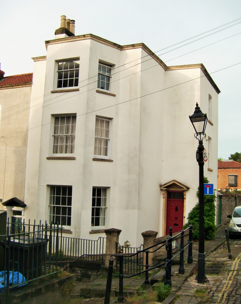
ST5873NE MONTAGUE HILL, Kingsdown 901-1/5/1519 (South West side) 13/12/73 No.25 and attached front area walls, piers and railings (Formerly Listed as: MONTAGUE HILL Nos.23-25 (Consecutive))
GV II
Attached house. Late C18. Render with limestone dressings, roof not visible. Double-depth plan. Late Georgian style. 3 storeys and basement; 1 bay. Moulded coping to the parapet; right-hand entrance block set back, the doorway with thin brackets to a pediment, 3-light overlight and 6-panel door; full-height central canted bay has 6/6-pane sashes, 3/6-panes on the second floor. Basement projects below the front area, with a low, brick segmental-arched doorway. INTERIOR not inspected. SUBSIDIARY FEATURES: attached rubble wall with saddleback coping to the right; capped piers and railings to the front area.
Listing NGR: ST5871273784
External links are from the relevant listing authority and, where applicable, Wikidata. Wikidata IDs may be related buildings as well as this specific building. If you want to add or update a link, you will need to do so by editing the Wikidata entry.


Other nearby listed buildings