Latitude: 51.8771 / 51°52'37"N
Longitude: -2.4411 / 2°26'27"W
OS Eastings: 369732
OS Northings: 219927
OS Grid: SO697199
Mapcode National: GBR FY.RWN6
Mapcode Global: VH86S.M2VV
Plus Code: 9C3VVHG5+RH
Entry Name: Dursley Cross Farmhouse
Listing Date: 4 July 1985
Grade: II
Source: Historic England
Source ID: 1299181
English Heritage Legacy ID: 354198
ID on this website: 101299181
Location: Dursley Cross, Forest of Dean, Gloucestershire, GL17
County: Gloucestershire
District: Forest of Dean
Civil Parish: Longhope
Built-Up Area: Gander's Green
Traditional County: Gloucestershire
Lieutenancy Area (Ceremonial County): Gloucestershire
Church of England Parish: Longhope All Saints
Church of England Diocese: Gloucester
Tagged with: Farmhouse
SO 61 NE LONGHOPE GLOUCESTER ROAD (north side)
6/121 Dursley Cross Farmhouse
II
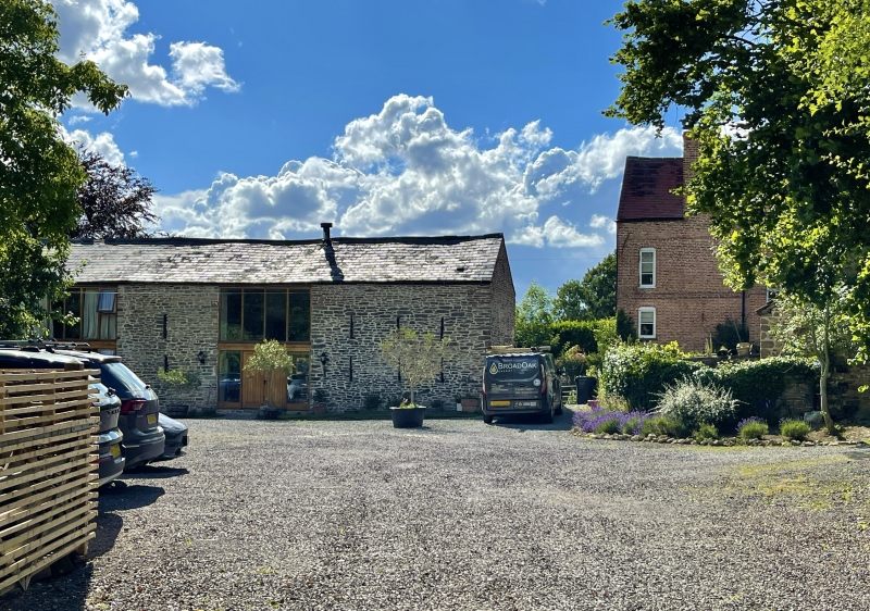
Farmhouse; early C18; Flemish-bond brickwork, with stone plinth to right gable: tiled roof. L-plan: projecting gabled stair turret in angle. Front 2-storey, with attics, cellar under right- hand end, access in gable. Main front 3 windows wide, outer 3- light wooden mullion and transom, centre 2-light; steep cambered heads to ground floor, segmental to first-floor windows, brick-on- end voussoirs. Plain string at first-floor level. Front door studded, boarded door with original knocker, latch and hinges, in heavy, chamfered frame: 2-pane fanlight over: up three steps. Late C20 porch replaced C19 one. Rear wing stone, one storey plus attics: far end contained cider house. Internally dado rail to hall; door below stairs original boarded with moulding to edge of wider ones: two similar doors to rear of left-hand room with grilles over. Evidence of cruck truss surviving in rear wing.
Listing NGR: SO6973219927
External links are from the relevant listing authority and, where applicable, Wikidata. Wikidata IDs may be related buildings as well as this specific building. If you want to add or update a link, you will need to do so by editing the Wikidata entry.


Other nearby listed buildings