Approximate Location Map
Large Map »
Latitude: 54.7772 / 54°46'37"N
Longitude: -1.8533 / 1°51'11"W
OS Eastings: 409534
OS Northings: 542484
OS Grid: NZ095424
Mapcode National: GBR HFH6.K9
Mapcode Global: WHC4L.H6P2
Plus Code: 9C6WQ4GW+VM
Entry Name: Milestone Circa 100 Metres South of Drover House
Listing Date: 24 June 1987
Grade: II
Source: Historic England
Source ID: 1299412
English Heritage Legacy ID: 350614
ID on this website: 101299412
Location: County Durham, DL13
County: County Durham
Civil Parish: Satley
Traditional County: Durham
Lieutenancy Area (Ceremonial County): County Durham
Church of England Parish: Satley
Church of England Diocese: Durham
Tagged with: Milestone
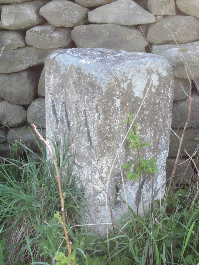
SATLEY A68 (East side)
NZ 04 SE NZ 09394407
8/107 Milestone c.100
metres south of
Drover House
II
Milestone. Late C18 for West Auckland and Corbridge turnpike. Painted ashlar.
Quadrant-section block, about 1/2 metre high, with flat top. North face has
incised WA13 and south face C17 in Roman capitals, painted black. Stone
painted white.
Listing NGR: NZ0953442484
External links are from the relevant listing authority and, where applicable, Wikidata. Wikidata IDs may be related buildings as well as this specific building. If you want to add or update a link, you will need to do so by editing the Wikidata entry.


Other nearby listed buildings
