Latitude: 52.0807 / 52°4'50"N
Longitude: -1.6107 / 1°36'38"W
OS Eastings: 426773
OS Northings: 242549
OS Grid: SP267425
Mapcode National: GBR 5PM.FMD
Mapcode Global: VHBYG.1YBV
Plus Code: 9C4W39JQ+7P
Entry Name: Old Farmhouse and Attached Barn
Listing Date: 2 September 1952
Last Amended: 30 June 1986
Grade: II
Source: Historic England
Source ID: 1299465
English Heritage Legacy ID: 305905
ID on this website: 101299465
Location: Honington, Stratford-on-Avon, Warwickshire, CV36
County: Warwickshire
District: Stratford-on-Avon
Civil Parish: Honington
Traditional County: Warwickshire
Lieutenancy Area (Ceremonial County): Warwickshire
Church of England Parish: Honington All Saints
Church of England Diocese: Coventry
Tagged with: Farmhouse
HONINGTON SP2642 10/142 Old Farmhouse and attached 02/09/52 barn (Formerly listed as Old Farm Farmhouse)
GV II
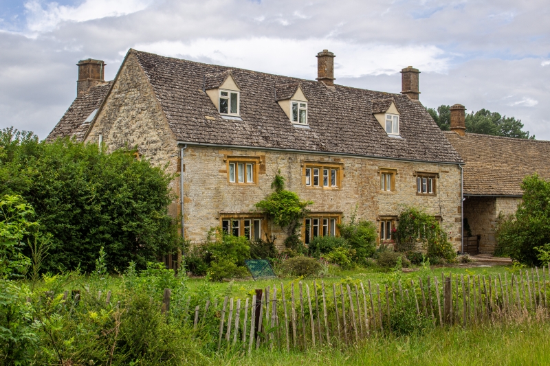
Farmhouse, now house. Mid/late C17. Squared coursed limestone. Steeply pitched stone slate roof laid to diminishing courses. Renewed stone ridge and end stacks. L-plan. 2 storeys plus attic. 4-window range. Elevation to road: ground floor has two 4-light stone-mullioned windows with king mullions, a 2-light stone-mullioned window and a 4-light stone-mullioned window to right. First floor has two 4-light, and a 2-light and 3-light stone mullioned windows. All mullioned windows have hood moulds and label stops. Some renewed stonework. 3 gabled roof dormers. Limestone quoins. Entrance to rear. Gabled 2-storey wing to left has stone-mullioned windows. Barn attached to right. Interiors not inspected.
Listing NGR: SP2677342549
External links are from the relevant listing authority and, where applicable, Wikidata. Wikidata IDs may be related buildings as well as this specific building. If you want to add or update a link, you will need to do so by editing the Wikidata entry.


Other nearby listed buildings