Latitude: 51.5558 / 51°33'20"N
Longitude: -1.6947 / 1°41'41"W
OS Eastings: 421259
OS Northings: 184146
OS Grid: SU212841
Mapcode National: GBR 4VK.J9Z
Mapcode Global: VHC13.K5X4
Plus Code: 9C3WH844+84
Entry Name: Village Pump
Listing Date: 20 September 1979
Grade: II
Source: Historic England
Source ID: 1299600
English Heritage Legacy ID: 318582
ID on this website: 101299600
Location: Horpit, Swindon, Wiltshire, SN4
County: Swindon
Civil Parish: Wanborough
Traditional County: Wiltshire
Lieutenancy Area (Ceremonial County): Wiltshire
Church of England Parish: Lyddington and Wanborough
Church of England Diocese: Bristol
Tagged with: Well
1.
5410 WANBOROUGH HORPIT
Village pump
SU 28 SW 12/496
II
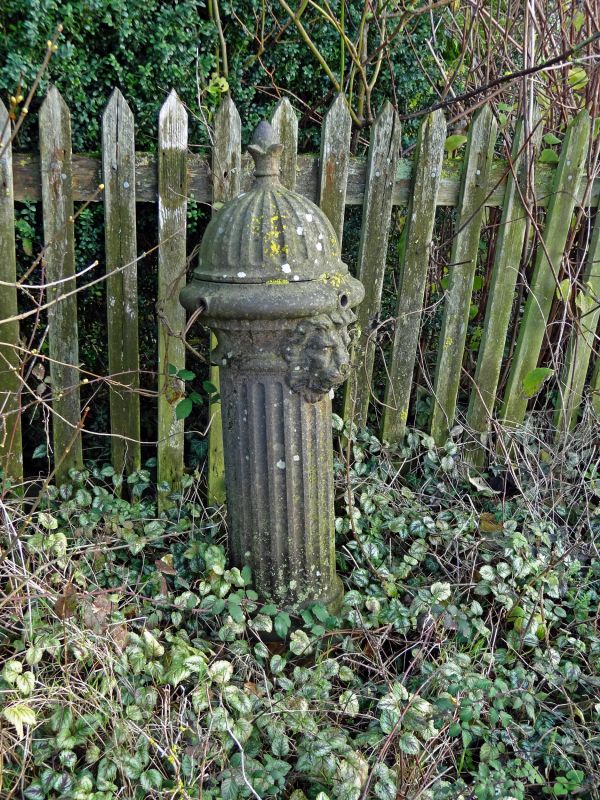
2.
Late C19. Standard fluted shaft with lion's head capping.
Listing NGR: SU2125984146
External links are from the relevant listing authority and, where applicable, Wikidata. Wikidata IDs may be related buildings as well as this specific building. If you want to add or update a link, you will need to do so by editing the Wikidata entry.


Other nearby listed buildings