Approximate Location Map
Large Map »
Latitude: 54.9493 / 54°56'57"N
Longitude: -1.3693 / 1°22'9"W
OS Eastings: 440496
OS Northings: 561804
OS Grid: NZ404618
Mapcode National: GBR LCW6.CM
Mapcode Global: WHD4Z.YV4Q
Plus Code: 9C6WWJXJ+P7
Entry Name: Steps, Walls and Piers to South of NO55 (Hill House)
Listing Date: 26 February 1985
Grade: II
Source: Historic England
Source ID: 1299620
English Heritage Legacy ID: 303699
ID on this website: 101299620
Location: Whitburn, South Tyneside, Tyne and Wear, SR6
County: South Tyneside
Electoral Ward/Division: Whitburn and Marsden
Parish: Non Civil Parish
Built-Up Area: Whitburn
Traditional County: Durham
Lieutenancy Area (Ceremonial County): Tyne and Wear
Church of England Parish: Whitburn
Church of England Diocese: Durham
Tagged with: Architectural structure
NZ 46SW BOLDON FRONT STREET (north side)
Whitburn
4/40
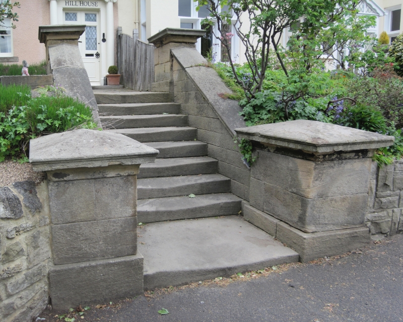
Steps, walls and piers to
- south of No 55 (Hill House)
GV II
C19. Ashlar. South of the entrance to the house are stone steps flanked by
low stone walls, with coping, terminating in 4 low piers with projecting cornices.
Listing NGR: NZ4049661804
External links are from the relevant listing authority and, where applicable, Wikidata. Wikidata IDs may be related buildings as well as this specific building. If you want to add or update a link, you will need to do so by editing the Wikidata entry.


Other nearby listed buildings
