Latitude: 52.2587 / 52°15'31"N
Longitude: -1.2801 / 1°16'48"W
OS Eastings: 449230
OS Northings: 262525
OS Grid: SP492625
Mapcode National: GBR 7QL.76G
Mapcode Global: VHCV9.RHLB
Plus Code: 9C4W7P59+FW
Entry Name: Red House Farm House and Attached Outbuildings
Listing Date: 30 May 1967
Last Amended: 21 April 1986
Grade: II
Source: Historic England
Source ID: 1299673
English Heritage Legacy ID: 305626
ID on this website: 101299673
Location: Lower Shuckburgh, Stratford-on-Avon, Warwickshire, NN11
County: Warwickshire
District: Stratford-on-Avon
Civil Parish: Upper and Lower Shuckburgh
Traditional County: Warwickshire
Lieutenancy Area (Ceremonial County): Warwickshire
Church of England Parish: Lower Shuckburgh St John the Baptist
Church of England Diocese: Coventry
Tagged with: Farmhouse
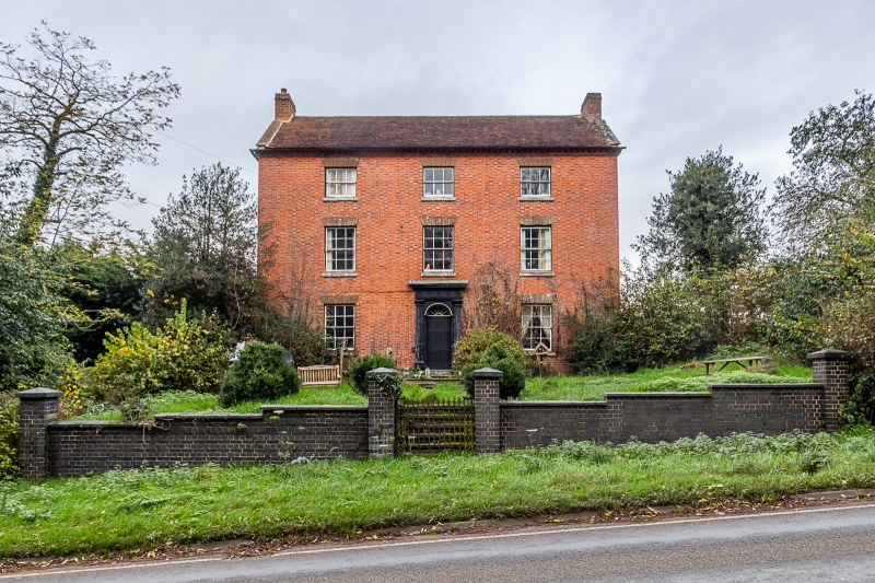
LOWER SHUCKBURGH DAVENTRY ROAD SP46SE (North side) 2/50 Red House Farm House and 30/05/67 attached outbuildings (Formerly listed as Red House Farm House)
II
Farmhouse. Late C18. Flemish bond red brick with moulded dentil cornice. Old tile roof has stone coped gable parapets; brick end stacks. L-plan, with wing on right to rear. 3 storeys; 3-window range. Central 6-panelled door and fanlight have panelled intrados. Moulded wood Roman Doric doorcase with pilasters. Sashes with rusticated stone lintels. Left return side: 3-window range; outer bays blind. 2-light casements with horizontal glazing bars. Dentil cornice continued across gable. Interior not inspected. Early c19 outbuildings of brick. Slate roof. L-plan. Segmental carriage arch. Plank door on left.
Listing NGR: SP4923062525
External links are from the relevant listing authority and, where applicable, Wikidata. Wikidata IDs may be related buildings as well as this specific building. If you want to add or update a link, you will need to do so by editing the Wikidata entry.


Other nearby listed buildings