Latitude: 51.2494 / 51°14'57"N
Longitude: 0.936 / 0°56'9"E
OS Eastings: 604996
OS Northings: 154124
OS Grid: TR049541
Mapcode National: GBR SWY.PGC
Mapcode Global: VHKK3.5VPK
Plus Code: 9F326WXP+QC
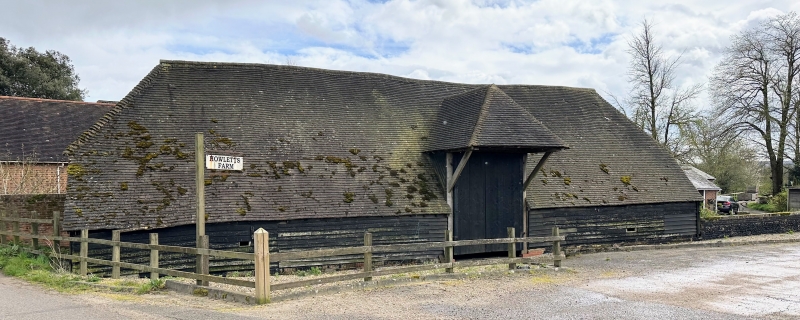
Entry Name: Barn 10 Yards West of Howlett's Farmhouse
Listing Date: 13 August 1984
Grade: II
Source: Historic England
Source ID: 1299777
English Heritage Legacy ID: 181423
ID on this website: 101299777
Location: Shottenden, Ashford, Kent, CT4
County: Kent
District: Ashford
Civil Parish: Chilham
Traditional County: Kent
Lieutenancy Area (Ceremonial County): Kent
Tagged with: Barn
TR 05 SW CHILHAM
3/50 Barn 10 yards west
of Howlett's Farmhouse
II
Barn. C18. Timberframed on brick plinth and clad in weather
board; plain tile hipped roof. Hipped mid-streys. Interior:
6 bays with aisles; clasped purlin roof.
Listing NGR: TR0648553998
External links are from the relevant listing authority and, where applicable, Wikidata. Wikidata IDs may be related buildings as well as this specific building. If you want to add or update a link, you will need to do so by editing the Wikidata entry.


Other nearby listed buildings