Approximate Location Map
Large Map »
Latitude: 51.1284 / 51°7'42"N
Longitude: 0.7588 / 0°45'31"E
OS Eastings: 593134
OS Northings: 140188
OS Grid: TQ931401
Mapcode National: GBR RWY.0PW
Mapcode Global: VHKKL.3WHV
Plus Code: 9F324QH5+9G
Entry Name: Oasthouse to South of Thorne Farmhouse
Listing Date: 10 October 1980
Grade: II
Source: Historic England
Source ID: 1299796
English Heritage Legacy ID: 180612
ID on this website: 101299796
Location: Bethersden, Ashford, Kent, TN26
County: Kent
District: Ashford
Civil Parish: Bethersden
Built-Up Area: Bethersden
Traditional County: Kent
Lieutenancy Area (Ceremonial County): Kent
Tagged with: Drying house
1.
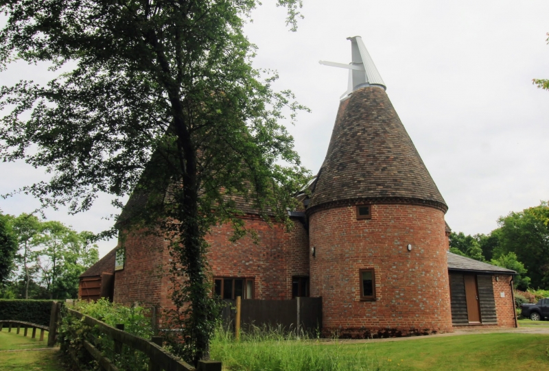
5272 BETHERSDEN FORGE HILL
Oasthouse to south of
Thorne Farmhouse
TQ 9340 21/16B
II GV
2.
C18 2 storey weatherboarded outbuilding, with half-hipped tiled roof. Attached
are 2 square brick oasts with modillion cornice and pyramidal roofs with cowls
and fantails and one circular brick oast.
Listing NGR: TQ9313440188
External links are from the relevant listing authority and, where applicable, Wikidata. Wikidata IDs may be related buildings as well as this specific building. If you want to add or update a link, you will need to do so by editing the Wikidata entry.


Other nearby listed buildings
