Latitude: 52.5767 / 52°34'36"N
Longitude: -1.5449 / 1°32'41"W
OS Eastings: 430938
OS Northings: 297752
OS Grid: SP309977
Mapcode National: GBR 6K1.D7Z
Mapcode Global: WHCHD.7HLG
Plus Code: 9C4WHFG4+M2
Entry Name: 133, Long Street
Listing Date: 5 April 1987
Grade: II
Source: Historic England
Source ID: 1299802
English Heritage Legacy ID: 309150
ID on this website: 101299802
Location: Atherstone, North Warwickshire, CV9
County: Warwickshire
District: North Warwickshire
Civil Parish: Atherstone
Built-Up Area: Atherstone
Traditional County: Warwickshire
Lieutenancy Area (Ceremonial County): Warwickshire
Church of England Parish: Atherstone St Mary
Church of England Diocese: Coventry
Tagged with: Building
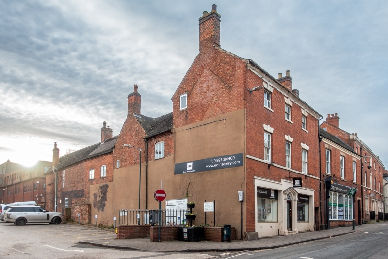
ATHERSTONE LONG STREET SP3097 (South-west side) 9/62 No. 133 05/04/87 GV II House, now offices; end of row. Late C18/early C19, with early/mid C19 additions to rear. Flemish bond brick with moulded rendered cornice. Old plain-tile roof; brick end stacks. L-plan with long wing on right to rear. 3 storeys; 3-window range. Almost symmetrical front has rendered doorcase of pilasters with fluted capitals and paterae, open pediment and fanlight. Late C20 glazed doors. C20 shop windows and doorcase have C20 rendered surround. First floor has sill course. Upper floors have sashes, 16-pane to right and 6-pane to second floor; rusticated rendered flat arches with keyblocks. Interior is altered on ground floor.
Listing NGR: SP3093897752
External links are from the relevant listing authority and, where applicable, Wikidata. Wikidata IDs may be related buildings as well as this specific building. If you want to add or update a link, you will need to do so by editing the Wikidata entry.


Other nearby listed buildings