Latitude: 51.3271 / 51°19'37"N
Longitude: -1.7965 / 1°47'47"W
OS Eastings: 414276
OS Northings: 158689
OS Grid: SU142586
Mapcode National: GBR 4Y4.NMH
Mapcode Global: VHB4K.TX40
Plus Code: 9C3W86G3+VC
Entry Name: Church
Listing Date: 3 June 1986
Grade: II
Source: Historic England
Source ID: 1300147
English Heritage Legacy ID: 311024
Also known as: Manningford Abbotts Church
ID on this website: 101300147
Location: Manningford Abbas Church, Manningford Bruce, Wiltshire, SN9
County: Wiltshire
Civil Parish: Manningford
Traditional County: Wiltshire
Lieutenancy Area (Ceremonial County): Wiltshire
Tagged with: Church building
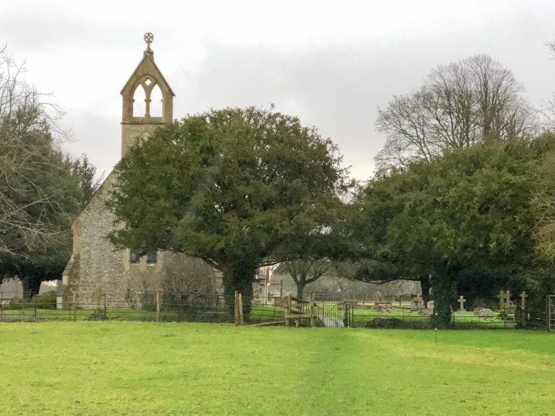
MANNINGFORD MANNINGFORD ABBOTS SU 15 NW (west side) 2/73 Church II Anglican parish church. 1861-4, by S.B. Gabriel of Bristol. Limestone and malmstone rubble, plain and fish-tailed tiles. Nave, Chancel and south porch. Nave with 1, 2 and 3-light plate tracery; hoodmould with carved terminals to west window only. Angle buttresses to west end. Tall 2-light bellcote with floriated cross. Gabled south porch with arris roll and hoodmould. Chancel has shouldered windows and a 3-light east window. Trefoiled priest's door. Trefoiled also the ridge tiles and crosses to gables. Interior: Open roof. Octagonal font.
Listing NGR: SU1427658689
External links are from the relevant listing authority and, where applicable, Wikidata. Wikidata IDs may be related buildings as well as this specific building. If you want to add or update a link, you will need to do so by editing the Wikidata entry.


Other nearby listed buildings