Latitude: 51.1581 / 51°9'28"N
Longitude: 0.8798 / 0°52'47"E
OS Eastings: 601468
OS Northings: 143809
OS Grid: TR014438
Mapcode National: GBR SY1.78F
Mapcode Global: VHKKN.65G2
Plus Code: 9F325V5H+6W
Entry Name: Former barn to south west of Bybrook
Listing Date: 11 August 1971
Last Amended: 4 July 1986
Grade: II
Source: Historic England
Source ID: 1300231
English Heritage Legacy ID: 179882
ID on this website: 101300231
Location: Bybrook, Ashford, Kent, TN24
County: Kent
District: Ashford
Electoral Ward/Division: Bybrook
Parish: Kennington
Built-Up Area: Ashford (Ashford)
Traditional County: Kent
Lieutenancy Area (Ceremonial County): Kent
Tagged with: Barn
This list entry was subject to a Minor Amendment on 9 May 2024 to update the name and address and to reformat the text to current standards
TR 04 SW
3/90B
CANTERBURY ROAD (west side)
The Bybrook Barn
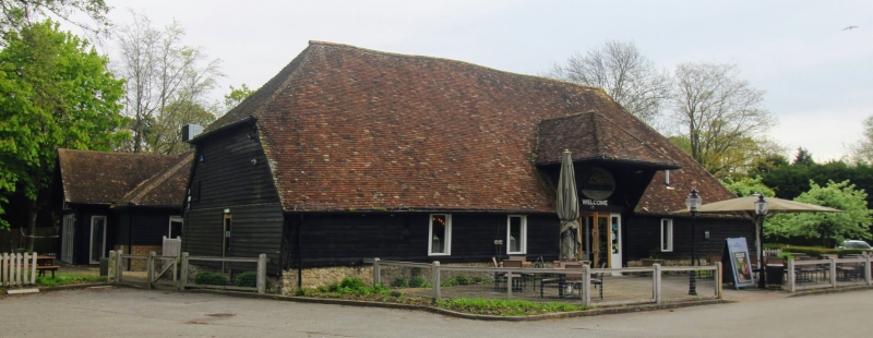
Former barn to south west of Bybrook
(Formerly Barn to south-west of Bybrook, previously listed as Old Barn at Bybrook House)
11.8.71
GV
II
C17 or earlier. Aisled timber barn weatherboarded on stone base. Steeply pitched tiled roof. Centre hipped pentice.
Bybrook, outhouses and barn form a group.
Listing NGR: TR0150643837
External links are from the relevant listing authority and, where applicable, Wikidata. Wikidata IDs may be related buildings as well as this specific building. If you want to add or update a link, you will need to do so by editing the Wikidata entry.


Other nearby listed buildings