Latitude: 51.4644 / 51°27'51"N
Longitude: -0.1128 / 0°6'46"W
OS Eastings: 531190
OS Northings: 175625
OS Grid: TQ311756
Mapcode National: GBR LY.T7
Mapcode Global: VHGR6.0G67
Plus Code: 9C3XFV7P+QV
Entry Name: Former St John's Church of England School
Listing Date: 13 April 1978
Grade: II
Source: Historic England
Source ID: 1300390
English Heritage Legacy ID: 204094
ID on this website: 101300390
Location: Brixton, Lambeth, London, SW9
County: London
District: Lambeth
Electoral Ward/Division: Coldharbour
Parish: Non Civil Parish
Built-Up Area: Lambeth
Traditional County: Surrey
Lieutenancy Area (Ceremonial County): Greater London
Church of England Parish: Angell Town St John the Evangelist
Church of England Diocese: Southwark
Tagged with: School building
CANTERBURY CRESCENT SW9 1. (north side) 5023 Former St John's Church of England School TQ 3175 18/152 13.4.78
II
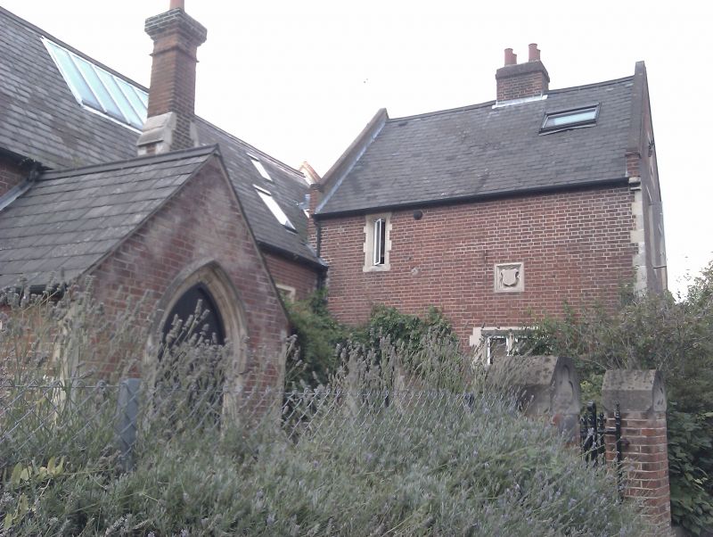
2. 1853 by Benjamin Ferrey. Irregular building in Tudor style. Central range with projecting south-east and north-west wings. One storey and attics. Red brick with Portland stone quoins and dressings. Fairly high pitched slated roofs, now bitumen-coated. Tall brick chimneys breaking eaves. Several gabled porch projections. Entrance doors pointed-arched with hoodmoulds. Doors and windows have irregular-block stone jambs. Chimneys projects with offsets and are quoined. Blank stone escutcheons in gable ends. Later north-west extensions.
Listing NGR: TQ3119075625
External links are from the relevant listing authority and, where applicable, Wikidata. Wikidata IDs may be related buildings as well as this specific building. If you want to add or update a link, you will need to do so by editing the Wikidata entry.


Other nearby listed buildings