Latitude: 51.431 / 51°25'51"N
Longitude: -1.6404 / 1°38'25"W
OS Eastings: 425095
OS Northings: 170284
OS Grid: SU250702
Mapcode National: GBR 5YJ.63G
Mapcode Global: VHC1Q.J94B
Plus Code: 9C3WC9J5+CR
Entry Name: Axford Farmhouse
Listing Date: 22 August 1966
Grade: I
Source: Historic England
Source ID: 1300471
English Heritage Legacy ID: 310634
ID on this website: 101300471
Location: Wiltshire, SN8
County: Wiltshire
Civil Parish: Ramsbury
Traditional County: Wiltshire
Lieutenancy Area (Ceremonial County): Wiltshire
Tagged with: Farmhouse
SU 27 SE RAMSBURY AXFORD
4/171 Axford Farmhouse 22.8.66
I
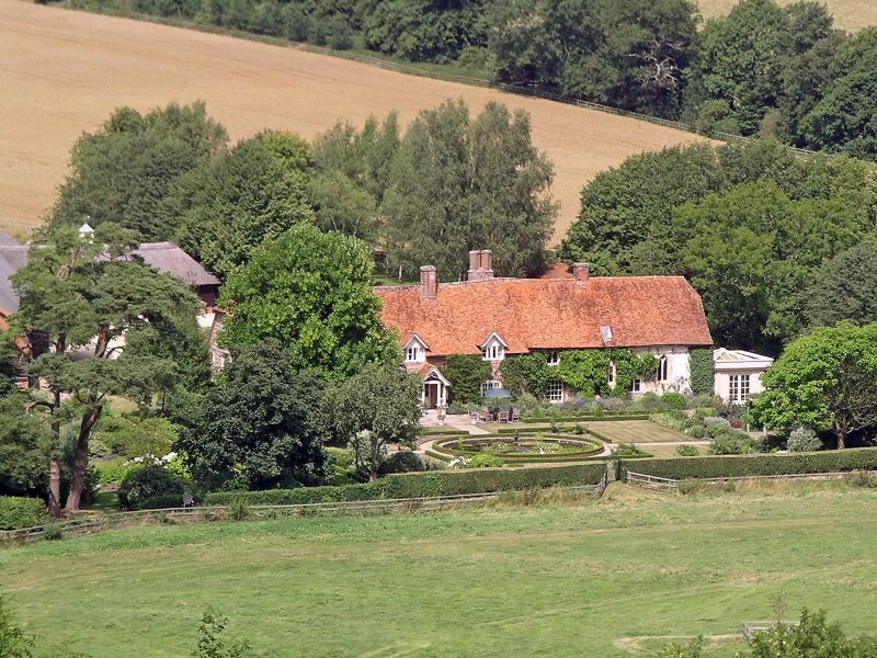
House, medieval, C17 and C19, incorporating chapel of c1250 - 1300. House brick laced flint with stone slate roof 5-6 bays, 2-storey. Cross passage with heated chamber to left incorporating medieval open hall. South wing of 2 bays now part kitchen, dated on gable 1660 S.E.P. reset in C19 alterations. 6-panelled door. Various timber windows. On south, gabled porch of C19. 3 stacks, two with initials E. P. part rebuilt in C19 with diagonal brick shafts. Roof quarter-hipped at ends. Interior of house has central truss over former hall with complete smoke blackened bay to east, and half bay to right with trimmer for louvre. Collar has knee braces and canted struts, the blade and braces having three hollow chamfers. Chapel attached to east gable of farmhouse, late C13. Rendered flint with ashlar quoins and tiled roof. 3 bays, now with inserted floor. Door on south, keeled nook shafts with bell capitals and simple keeled roll with hoodmould. East of door 2 windows of 'Y' tracery in 2 chamfered orders. Bay west of door with blocked square-headed window and probable second replaced with sash. Upper 2-light ogee-headed cinquefoiled lights with mouchette spandrels. Interior now outbuilding: fine piscina with credence shelf, all under cinquefoiled head. Bowl of piscina supported by column no incorporated into wall. Roof C17 replacement with timber framed gable, perhaps earlier. East wall below gable rebuilt in concrete blocks.
Listing NGR: SU2509170286
External links are from the relevant listing authority and, where applicable, Wikidata. Wikidata IDs may be related buildings as well as this specific building. If you want to add or update a link, you will need to do so by editing the Wikidata entry.


Other nearby listed buildings