Latitude: 51.7626 / 51°45'45"N
Longitude: -1.2627 / 1°15'45"W
OS Eastings: 450980
OS Northings: 207363
OS Grid: SP509073
Mapcode National: GBR 7XL.KKW
Mapcode Global: VHCXN.2Y9N
Plus Code: 9C3WQP7P+3W
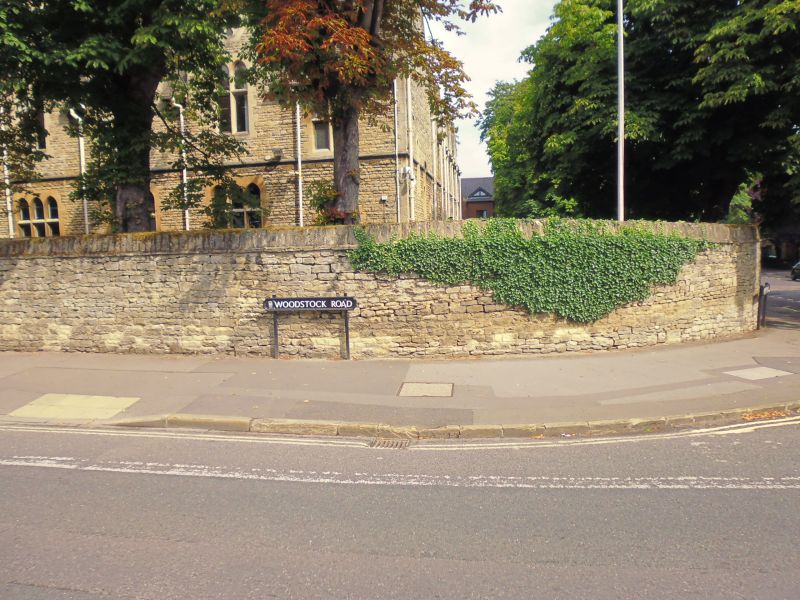
Entry Name: St Antony's College, Boundary Wall
Listing Date: 28 June 1972
Grade: II
Source: Historic England
Source ID: 1300509
English Heritage Legacy ID: 245108
ID on this website: 101300509
Location: Norham Manor, Oxford, Oxfordshire, OX2
County: Oxfordshire
District: Oxford
Electoral Ward/Division: North
Parish: Non Civil Parish
Built-Up Area: Oxford
Traditional County: Oxfordshire
Lieutenancy Area (Ceremonial County): Oxfordshire
Church of England Parish: Oxford St Philip and St James with St Margaret
Church of England Diocese: Oxford
Tagged with: Architectural structure
This list entry was subject to a Minor Amendment on 22 September 2025 to amend the name and address and to reformat the text to current standards
SP 5007 SE 2/651B
SP 5107 SW 3/651B
ST ANTONY'S COLLEGE
Boundary wall
(Formerly listed as ST ANTHONY'S COLLEGE, Boundary wall)
II
Contemporary with the buildings. Coursed rubble wall fronting Woodstock Road, Bevington Road and Winchester Road.
Listing NGR: SP5098007363
External links are from the relevant listing authority and, where applicable, Wikidata. Wikidata IDs may be related buildings as well as this specific building. If you want to add or update a link, you will need to do so by editing the Wikidata entry.


Other nearby listed buildings