Latitude: 50.9928 / 50°59'34"N
Longitude: -1.7441 / 1°44'38"W
OS Eastings: 418055
OS Northings: 121522
OS Grid: SU180215
Mapcode National: GBR 528.PVW
Mapcode Global: FRA 767H.8CD
Plus Code: 9C2WX7V4+49
Entry Name: 3 and 5, High Street
Listing Date: 4 July 1985
Grade: II
Source: Historic England
Source ID: 1300545
English Heritage Legacy ID: 319642
ID on this website: 101300545
Location: Downton, Wiltshire, SP5
County: Wiltshire
Civil Parish: Downton
Built-Up Area: Downton
Traditional County: Wiltshire
Lieutenancy Area (Ceremonial County): Wiltshire
Church of England Parish: Downton St Lawrence
Church of England Diocese: Salisbury
Tagged with: Building
DOWNTON HIGH STREET SU 1821 (north side) 6/83 Nos 3 and 5
GV II
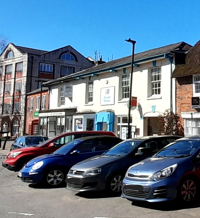
Pair of shops. Early C19. Plastered brick, Welsh slate hipped roof, brick stacks. 2-storey, 4-window. To left is C19 double shop front with double glazed doors, to No. 3. To right is double C19 shop front with bay windows and C20 door with keystone to lintel flanked by Tuscan columns, to right is elliptical-arched cart entry with keystone and imposts. Deep eaves to hipped roof. To rear of No. 3 is 2-storey brick wing with tiled roof. Interior not inspected.
Listing NGR: SU1805921529
External links are from the relevant listing authority and, where applicable, Wikidata. Wikidata IDs may be related buildings as well as this specific building. If you want to add or update a link, you will need to do so by editing the Wikidata entry.


Other nearby listed buildings