Approximate Location Map
Large Map »
Latitude: 51.8239 / 51°49'25"N
Longitude: -1.6637 / 1°39'49"W
OS Eastings: 423277
OS Northings: 213969
OS Grid: SP232139
Mapcode National: GBR 5SN.L6R
Mapcode Global: VHBZS.3FV5
Plus Code: 9C3WR8FP+GG
Entry Name: Lower Farmhouse
Listing Date: 12 September 1955
Last Amended: 21 August 1989
Grade: II
Source: Historic England
Source ID: 1300550
English Heritage Legacy ID: 253725
ID on this website: 101300550
Location: Taynton, West Oxfordshire, OX18
County: Oxfordshire
District: West Oxfordshire
Civil Parish: Taynton
Traditional County: Oxfordshire
Lieutenancy Area (Ceremonial County): Oxfordshire
Church of England Parish: Taynton
Church of England Diocese: Oxford
Tagged with: Farmhouse
TAYNTON
SP2313
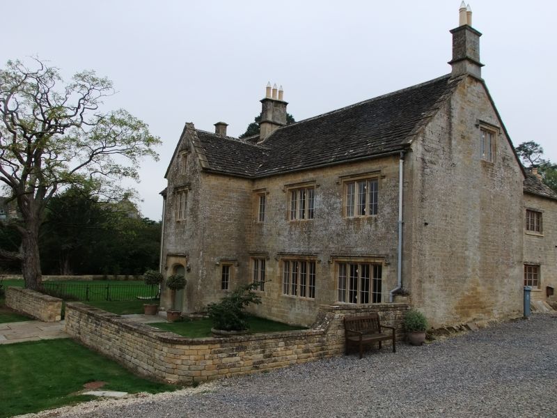
10/167 Lower Farmhouse
12/09/55 (Formerly listed as Lower
Farmhouse with Barn and
adjoining building)
GV II
Farmhouse. Probably mid C17. Stone ashlar, stone slate roof; stone end stacks,
ridge stack to left of centre. 2-storey, 5-window range, with porch of 2 storeys
and attic to left of centre. Ribbed door to 4-centre-arched doorway to left of
centre with hood mould and end stops. Two 4-light stone mullion windows with
hood moulds to right. 4-light stone mullion window with hood mould to left.
2-light stone mullion window with hood mould to right of centre. Two 3-light
stone mullion windows with hood moulds to first floor left. Single-light casement with
hood mould to right of centre. 2-light stone mullion window with hood mould to
first floor of porch. Single-light casement to attic cross-gable. Interior not
inspected but likely to be of interest.
Listing NGR: SP2327713969
External links are from the relevant listing authority and, where applicable, Wikidata. Wikidata IDs may be related buildings as well as this specific building. If you want to add or update a link, you will need to do so by editing the Wikidata entry.


Other nearby listed buildings
