Approximate Location Map
Large Map »
Latitude: 52.2097 / 52°12'34"N
Longitude: 0.1438 / 0°8'37"E
OS Eastings: 546579
OS Northings: 258993
OS Grid: TL465589
Mapcode National: GBR L7B.F5R
Mapcode Global: VHHK3.FQXF
Plus Code: 9F42645V+VG
Entry Name: 247, Newmarket Road
Listing Date: 3 February 1994
Grade: II
Source: Historic England
Source ID: 1300768
English Heritage Legacy ID: 350346
ID on this website: 101300768
Location: Romsey Town, Cambridge, Cambridgeshire, CB5
County: Cambridgeshire
District: Cambridge
Electoral Ward/Division: Abbey
Parish: Non Civil Parish
Built-Up Area: Cambridge
Traditional County: Cambridgeshire
Lieutenancy Area (Ceremonial County): Cambridgeshire
Church of England Parish: Cambridge St Andrew the Less
Church of England Diocese: Ely
Tagged with: Building
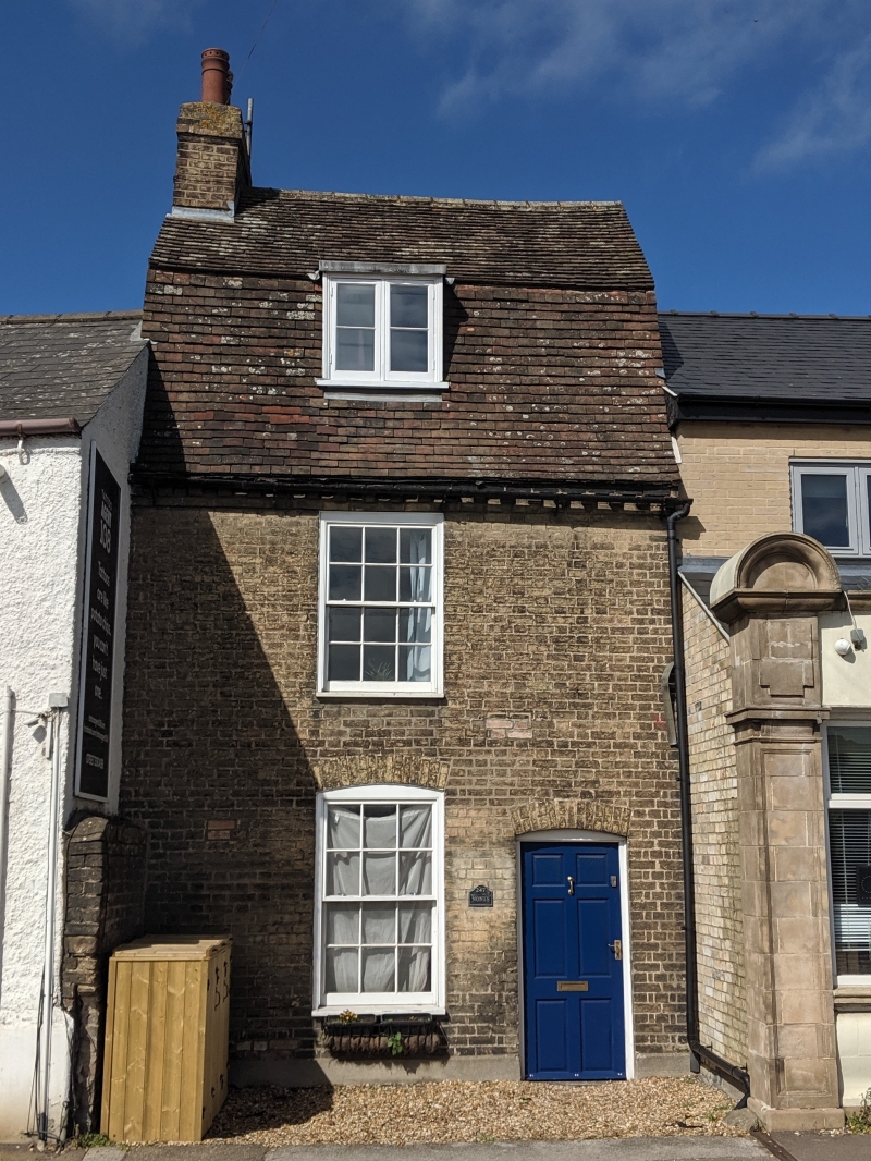
CAMBRIDGE NEWMARKET ROAD
TL 45 NE
(north side)
667- /21/10037 No.247
II
House. Early C19. Gault brick with plain-tile mansard roof and brick left end stack. 2 storeys
and attic; single-window range of 6/6 sashes. Door to right. Dentilled eaves and 2-light
dormer.
Listing NGR: TL4657958993
External links are from the relevant listing authority and, where applicable, Wikidata. Wikidata IDs may be related buildings as well as this specific building. If you want to add or update a link, you will need to do so by editing the Wikidata entry.


Other nearby listed buildings
