Approximate Location Map
Large Map »
Latitude: 51.7979 / 51°47'52"N
Longitude: -1.5401 / 1°32'24"W
OS Eastings: 431811
OS Northings: 211123
OS Grid: SP318111
Mapcode National: GBR 6VJ.7FF
Mapcode Global: VHC01.825L
Plus Code: 9C3WQFX5+4X
Entry Name: Minster Lovell Bridge
Listing Date: 12 September 1955
Grade: II
Source: Historic England
Source ID: 1300869
English Heritage Legacy ID: 253632
ID on this website: 101300869
Location: Little Minster, West Oxfordshire, OX29
County: Oxfordshire
District: West Oxfordshire
Civil Parish: Minster Lovell
Traditional County: Oxfordshire
Lieutenancy Area (Ceremonial County): Oxfordshire
Church of England Parish: Minster Lovell
Church of England Diocese: Oxford
Tagged with: Bridge
MINSTER LOVELL
SP3111
18/75
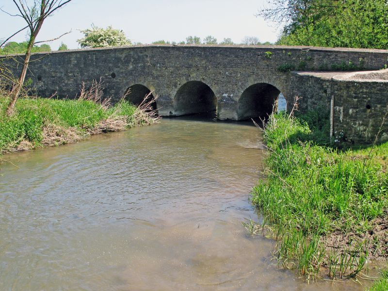
Minster Lovell Bridge
12/09/55
- II
Bridge. Probably early C19, possibly on earlier foundations. Squared coursed
stone. 3-arched bridge and single-arched bridge in one structure. Round arches
with ashlar voussoirs. Plain stone parapet. Carries road over river Windrush.
Listing NGR: SP3181111123
External links are from the relevant listing authority and, where applicable, Wikidata. Wikidata IDs may be related buildings as well as this specific building. If you want to add or update a link, you will need to do so by editing the Wikidata entry.


Other nearby listed buildings
