Latitude: 54.2722 / 54°16'19"N
Longitude: -2.0091 / 2°0'32"W
OS Eastings: 399505
OS Northings: 486283
OS Grid: SD995862
Mapcode National: GBR GMD1.T9
Mapcode Global: WHB5Q.3WK7
Plus Code: 9C6V7XCR+V9
Entry Name: Littleburn Bridge
Listing Date: 6 April 1988
Grade: II
Source: Historic England
Source ID: 1301709
English Heritage Legacy ID: 322623
ID on this website: 101301709
Location: Thoralby, North Yorkshire, DL8
County: North Yorkshire
District: Richmondshire
Civil Parish: Thoralby
Traditional County: Yorkshire
Lieutenancy Area (Ceremonial County): North Yorkshire
Tagged with: Bridge
THORALBY WESTFIELD LANE SD 98 NE 1/140 Littleburn Bridge GV II
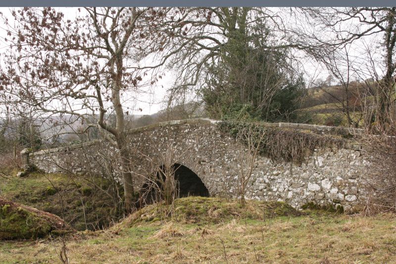
Bridge. Dated 1814. For the 4th Lord Rokeby of Littleburn House (qv). Rubble. Single segmental arch. Parapets terminate in square ashlar pedestals, with panelled sides and pyramidal tops. Ashlar coping, stones cramped together on parapet. On inside of downstream parapet, stone inscribed "AD 1814". On inside of upstream parapet, ashlar sandstone plaque with Latin inscription describing the destructive force of water and commemorating the Duke of Wellington's victories.
Listing NGR: SD9950586283
External links are from the relevant listing authority and, where applicable, Wikidata. Wikidata IDs may be related buildings as well as this specific building. If you want to add or update a link, you will need to do so by editing the Wikidata entry.


Other nearby listed buildings