Approximate Location Map
Large Map »
Latitude: 54.534 / 54°32'2"N
Longitude: -0.7486 / 0°44'54"W
OS Eastings: 481072
OS Northings: 516137
OS Grid: NZ810161
Mapcode National: GBR RJ60.QG
Mapcode Global: WHF8K.G9RH
Plus Code: 9C6XG7M2+JH
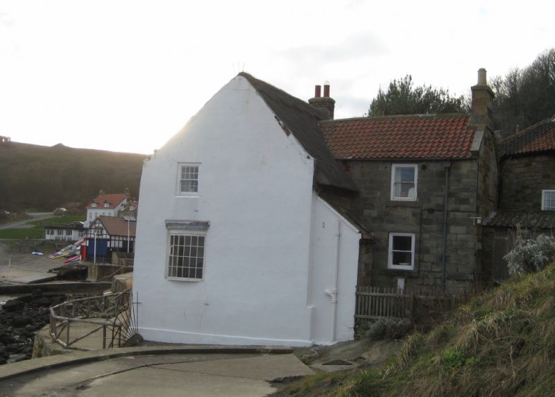
Entry Name: The Thatched Cottage
Listing Date: 10 December 1985
Grade: II
Source: Historic England
Source ID: 1301849
English Heritage Legacy ID: 327236
Also known as: Coastguard Cottage
ID on this website: 101301849
Location: Runswick Bay, North Yorkshire, TS13
County: North Yorkshire
District: Scarborough
Civil Parish: Hinderwell
Traditional County: Yorkshire
Lieutenancy Area (Ceremonial County): North Yorkshire
Church of England Parish: Hinderwell with Roxby and Staithes
Church of England Diocese: York
Tagged with: Cottage Thatched cottage
NZ 8016 HINDERWELL RUNSWICK BAY
10/161
- The Thatched Cottage
- II
House, late C18, slightly altered. Local stone. Thatched roof, copings missing.
Brick left end chimney. Two storeys, two windows, sashes with glazing bars, the
upper ones bow. Central 4-panel door.
Listing NGR: NZ8107216137
External links are from the relevant listing authority and, where applicable, Wikidata. Wikidata IDs may be related buildings as well as this specific building. If you want to add or update a link, you will need to do so by editing the Wikidata entry.


Other nearby listed buildings
