Latitude: 54.4835 / 54°29'0"N
Longitude: -1.5565 / 1°33'23"W
OS Eastings: 428831
OS Northings: 509888
OS Grid: NZ288098
Mapcode National: GBR KJKL.TK
Mapcode Global: WHC63.2K2Q
Plus Code: 9C6WFCMV+CC
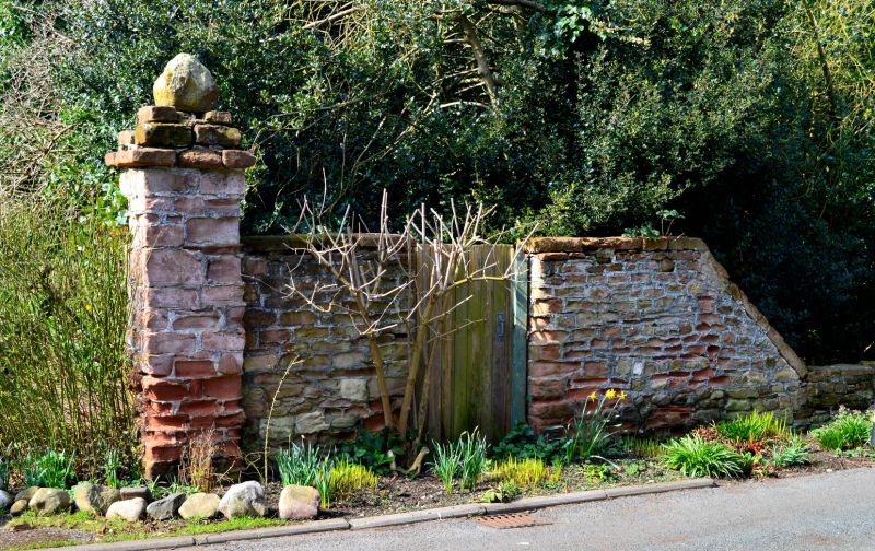
Entry Name: Gate Pier and Attached Wall Approximately 125 Metres South East of Monkend Hall
Listing Date: 29 January 1988
Grade: II
Source: Historic England
Source ID: 1301851
English Heritage Legacy ID: 322676
ID on this website: 101301851
NZ 2809-2909
10/37
CROFT-ON-TEES
MONKEND
(west side)
Gate pier and attached wall approximately 125 metres south-east of Monk End Hall
GV
II
Gate pier and attached wall. Probably early C18. Red sandstone. Square-
plan pier, approximately 3 metres high, with stepped top. Wall
approximately 4 metres long and 2 metres high, interrupted by boarded gate.
Listing NGR: NZ2883109888
External links are from the relevant listing authority and, where applicable, Wikidata. Wikidata IDs may be related buildings as well as this specific building. If you want to add or update a link, you will need to do so by editing the Wikidata entry.


Other nearby listed buildings