Approximate Location Map
Large Map »
Latitude: 54.2786 / 54°16'42"N
Longitude: -1.7796 / 1°46'46"W
OS Eastings: 414446
OS Northings: 487017
OS Grid: SE144870
Mapcode National: GBR JL0Z.J0
Mapcode Global: WHC6Y.MQRB
Plus Code: 9C6W76HC+C4
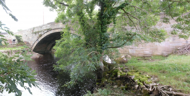
Entry Name: Cover Bridge
Listing Date: 25 June 1985
Grade: II
Source: Historic England
Source ID: 1302314
English Heritage Legacy ID: 321627
ID on this website: 101302314
Location: Ulshaw, North Yorkshire, DL8
County: North Yorkshire
District: Richmondshire
Civil Parish: East Witton
Traditional County: Yorkshire
Lieutenancy Area (Ceremonial County): North Yorkshire
Tagged with: Road bridge
SE 18 NW EAST WITTON TOWN COVER BRIDGE
3/5 Cover Bridge
GV II
Bridge. C18. Ashlar. Single segmental arch, in 2 longitudinal halves of
the same build, with even voussoirs. String course. Parapets have
saddleback coping and terminate in circular bollards.
Listing NGR: SE1444687017
External links are from the relevant listing authority and, where applicable, Wikidata. Wikidata IDs may be related buildings as well as this specific building. If you want to add or update a link, you will need to do so by editing the Wikidata entry.


Other nearby listed buildings
