Latitude: 51.4814 / 51°28'53"N
Longitude: -0.9995 / 0°59'58"W
OS Eastings: 469574
OS Northings: 176306
OS Grid: SU695763
Mapcode National: GBR QD4.MD
Mapcode Global: VHDWS.M1G4
Plus Code: 9C3XF2J2+H6
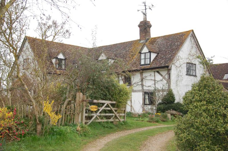
Entry Name: Lane Cottage
Listing Date: 12 September 1978
Grade: II
Source: Historic England
Source ID: 1302556
English Heritage Legacy ID: 39216
ID on this website: 101302556
Location: Reading, Berkshire, RG4
County: Reading
Electoral Ward/Division: Mapledurham
Parish: Non Civil Parish
Built-Up Area: Reading
Traditional County: Oxfordshire
Lieutenancy Area (Ceremonial County): Berkshire
Church of England Parish: Caversham Thameside and Mapledurham
Church of England Diocese: Oxford
Tagged with: Cottage
UPPER WOODCOTE ROAD 1. 5128 Blagrave Farm Lane Lane Cottage SU 67 NE 14/592 12.9.78. II GV 2. C16. 2 storeys. Square frame timber framed with colour-washed brick walls, except south wall of flint (obsucred), said to be dated 1701. Modern shingle roof replaces thatch. 1 window on 1st floor. 2 on ground floor. Door off-centre left. Central modern brick chimney.
Listing NGR: SU6957476306
External links are from the relevant listing authority and, where applicable, Wikidata. Wikidata IDs may be related buildings as well as this specific building. If you want to add or update a link, you will need to do so by editing the Wikidata entry.


Other nearby listed buildings