Approximate Location Map
Large Map »
Latitude: 51.457 / 51°27'25"N
Longitude: -0.9656 / 0°57'56"W
OS Eastings: 471964
OS Northings: 173617
OS Grid: SU719736
Mapcode National: GBR QNF.55
Mapcode Global: VHDWT.6MWY
Plus Code: 9C3XF24M+QQ
Entry Name: Wall between Forbury Road and Abbott's Walk to west of St James's Church
Listing Date: 14 December 1978
Grade: II
Source: Historic England
Source ID: 1303165
English Heritage Legacy ID: 38941
ID on this website: 101303165
Location: Reading, Berkshire, RG1
County: Reading
Electoral Ward/Division: Abbey
Parish: Non Civil Parish
Built-Up Area: Reading
Traditional County: Berkshire
Lieutenancy Area (Ceremonial County): Berkshire
Church of England Parish: Reading St Mary the Virgin
Church of England Diocese: Oxford
Tagged with: Wall
SU 7173 NE
1/486
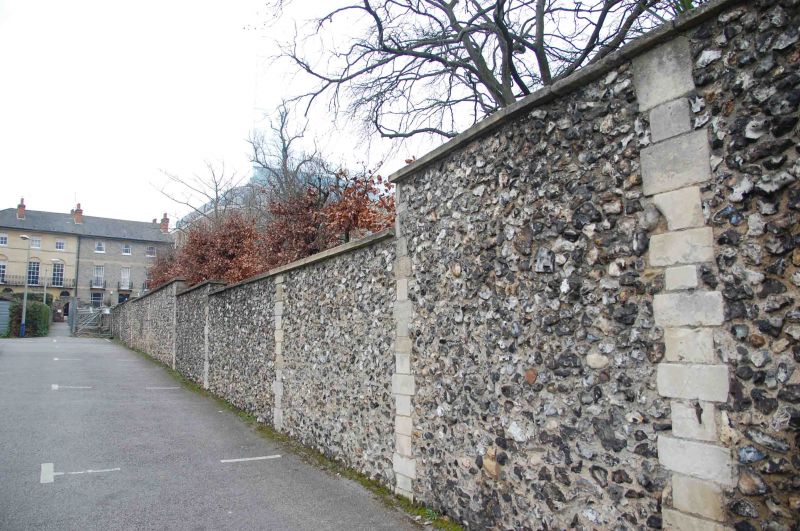
FORBURY ROAD (south side)
Wall between Forbury Road and Abbott's Walk to west of St James's Church
II
Bounds Forbury Gardens to east. Probably circa 1840 or 1855. Flint with Bath stone ashlar piers of varying height. Panels opposite the west front of St James's Church have C12 fragments of carving and architectural decoration. Ends in small gate to Abbot's Walk with arch of re-used voussoirs and chevron capitals (C12), stepped parapet over. Fragments of Norman Abbey to be found also in wall to west of St James's School playground.
Listing NGR: SU7196573617
External links are from the relevant listing authority and, where applicable, Wikidata. Wikidata IDs may be related buildings as well as this specific building. If you want to add or update a link, you will need to do so by editing the Wikidata entry.


Other nearby listed buildings
